Vignola geodata
Vignola (Trentino-Alto Adige) is a seat of a third-order administrative division; located in Italy in Europe/Rome (GMT+2) time zone. With population of 20 people, there are 11679 cities with bigger population in this country. Compared to other cities in Italy, 92.9% of cities are located further ↓South; 53.4% of cities are located further →East and 97% of cities have lower elevation than Vignola. Note1
Administrative division(s):
- Level 1: Trentino-Alto Adige
- Level 2: Provincia autonoma di Trento
- Level 3: Vignola-Falesina


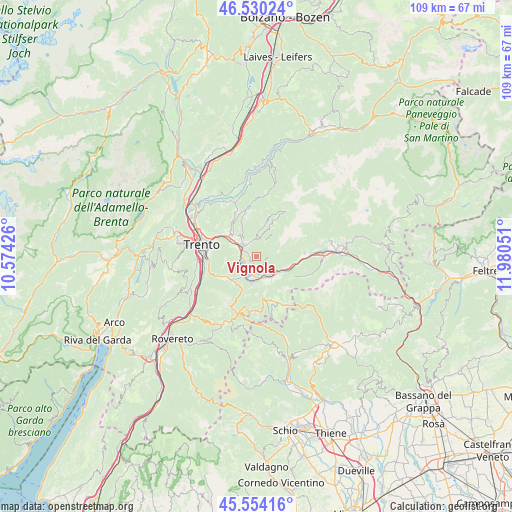
Vignola GPS coordinates[2]
46° 2' 39.696" North, 11° 16' 38.568" East
| Map corner | latitude | longitude |
|---|---|---|
| Upper-left | 46.53024°, | 10.57426° |
| Center: | 46.04436°, | 11.27738° |
| Lower-right: | 45.55416°, | 11.98051° |
| Map W x H: | 108.5×108.5 km | = 67.4×67.4mi |
| max Lat: | 47.04031° ⇑7.1% North |
| Vignola: | 46.04436° |
| min Lat: | ⇓92.9% South 35.50142° |
| min Long | Vignola | max Long |
| 6.69888° | 11.27738° | 18.48682° |
| W 46.6%⇐ | ⇒53.4% E |
Elevation
Elevation of Vignola is 994 m = 3261 ft, and this is 687.3 m = 2255 ft above average elevation for this country.
| Max E: |
2085 m = 6841 ft | 3% |
| Vignola | 994 m 3261 ft | |
| Avg. | 306.7 m = 1006 ft | |
Min E: |
-4 m = -13 ft | 97% |
See also: Italy elevation on elevation.city.
Geographical zone
Vignola is located in North temperate zone (between Tropic of Cancer and the Arctic Circle). Distance of this North polar circle is 2281.5 km =1417.7 mi to North.| Distance of | km | miles | from Vignola |
|---|---|---|---|
| North Pole | 4887.4 | 3036.9 | to North |
| Arctic Circle | 2281.5 | 1417.7 | to North |
| Tropic Cancer | 2513.7 | 1561.9 | to South |
| Equator | 5119.7 | 3181.2 | to South |


Nearby cities:
15 places around Vignola: (largest is in red/bold)
• Barco
6.5 km =4 mi,  133°
133°
• Bosentino-Migazzone
6.3 km =3.9 mi,  221°
221°
• Calceranica al Lago
5.1 km =3.2 mi,  210°
210°
• Caldonazzo
5.7 km =3.5 mi,  190°
190°
• Canale-San Cristoforo
3.6 km =2.2 mi,  266°
266°
• Canezza
3.7 km =2.3 mi,  359°
359°
• Frassilongo
5.3 km =3.3 mi,  16°
16°
• Levico Terme
4.1 km =2.5 mi,  149°
149°
• Madrano-Canzolino
6.4 km =4 mi,  313°
313°
• Novaledo
7.2 km =4.5 mi,  108°
108°
• Pergine Valsugana
3.8 km =2.4 mi, 305°
• Sant'Orsola
7.4 km =4.6 mi,  14°
14°
• Susà
4.4 km =2.7 mi,  279°
279°
• Tenna
3.3 km =2.1 mi,  197°
197°
• Vattaro
7.3 km =4.5 mi, 219°
Sources, notices
• [Note1] Compared only with cities in Italy existing in our database
• [Src1] Map data: © OpenStreetMap contributors (CC-BY-SA)
• [Src2] Other city data from geonames.org with taken over terms of usage.
• [Src3] Geographical zone / Annual Mean Temperature by Robert A. Rohde @ Wikipedia
