Susà geodata
Susà (Trentino-Alto Adige) is a populated place; located in Italy in Europe/Rome (GMT+2) time zone. With population of 775 people, there are 7789 cities with bigger population in this country. Compared to other cities in Italy, 93% of cities are located further ↓South; 54.2% of cities are located further →East and 82.6% of cities have lower elevation than Susà. Note1
Administrative division(s):
- Level 1: Trentino-Alto Adige
- Level 2: Provincia autonoma di Trento
- Level 3: Pergine Valsugana


Susà GPS coordinates[2]
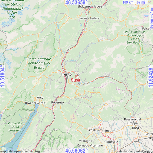
46° 3' 2.736" North, 11° 13' 16.176" East
| Map corner | latitude | longitude |
|---|---|---|
| Upper-left | 46.53659°, | 10.51804° |
| Center: | 46.05076°, | 11.22116° |
| Lower-right: | 45.56062°, | 11.92429° |
| Map W x H: | 108.5×108.5 km | = 67.4×67.4mi |
| max Lat: | 47.04031° ⇑7% North |
| Susà: | 46.05076° |
| min Lat: | ⇓93% South 35.50142° |
| min Long | Susà | max Long |
| 6.69888° | 11.22116° | 18.48682° |
| W 45.8%⇐ | ⇒54.2% E |
Elevation
Elevation of Susà is 564 m = 1850 ft, and this is 257.3 m = 844 ft above average elevation for this country.
| Max E: |
2085 m = 6841 ft | 17.4% |
| Susà | 564 m 1850 ft | |
| Avg. | 306.7 m = 1006 ft | |
Min E: |
-4 m = -13 ft | 82.6% |
See also: Italy elevation on elevation.city.
Geographical zone
Susà is located in North temperate zone (between Tropic of Cancer and the Arctic Circle). Distance of this North polar circle is 2280.8 km =1417.2 mi to North.| Distance of | km | miles | from Susà |
|---|---|---|---|
| North Pole | 4886.7 | 3036.5 | to North |
| Arctic Circle | 2280.8 | 1417.2 | to North |
| Tropic Cancer | 2514.4 | 1562.4 | to South |
| Equator | 5120.4 | 3181.7 | to South |


Nearby cities:
15 places around Susà: (largest is in red/bold)
• Bosentino-Migazzone
5.4 km =3.4 mi,  178°
178°
• Calceranica al Lago
5.4 km =3.4 mi,  161°
161°
• Canale-San Cristoforo
1.2 km =0.7 mi,  141°
141°
• Canezza
5.3 km =3.3 mi,  54°
54°
• Civezzano
5.3 km =3.3 mi,  328°
328°
• Madrano-Canzolino
3.8 km =2.4 mi,  355°
355°
• Pergine Valsugana
2 km =1.2 mi,  39°
39°
• Povo
5.4 km =3.4 mi,  289°
289°
• Seregnano
4.8 km =3 mi,  337°
337°
• Tavernaro
6.1 km =3.8 mi,  305°
305°
• Tenna
5.1 km =3.2 mi, 139°
• Vattaro
6.3 km =3.9 mi, 182°
• Vignola
4.4 km =2.7 mi,  99°
99°
• Vigolo Vattaro
5.4 km =3.4 mi,  199°
199°
• Villamontagna
6.2 km =3.9 mi, 309°
Sources, notices
• [Note1] Compared only with cities in Italy existing in our database
• [Src1] Map data: © OpenStreetMap contributors (CC-BY-SA)
• [Src2] Other city data from geonames.org with taken over terms of usage.
• [Src3] Geographical zone / Annual Mean Temperature by Robert A. Rohde @ Wikipedia
