Sant'Orsola geodata
Sant'Orsola (Trentino-Alto Adige) is a seat of a third-order administrative division; located in Italy in Europe/Rome (GMT+2) time zone. With population of 294 people, there are 10696 cities with bigger population in this country. Compared to other cities in Italy, 94.2% of cities are located further ↓South; 53.1% of cities are located further →East and 96.4% of cities have lower elevation than Sant'Orsola. Note1
Administrative division(s):
- Level 1: Trentino-Alto Adige
- Level 2: Provincia autonoma di Trento
- Level 3: Sant'Orsola Terme


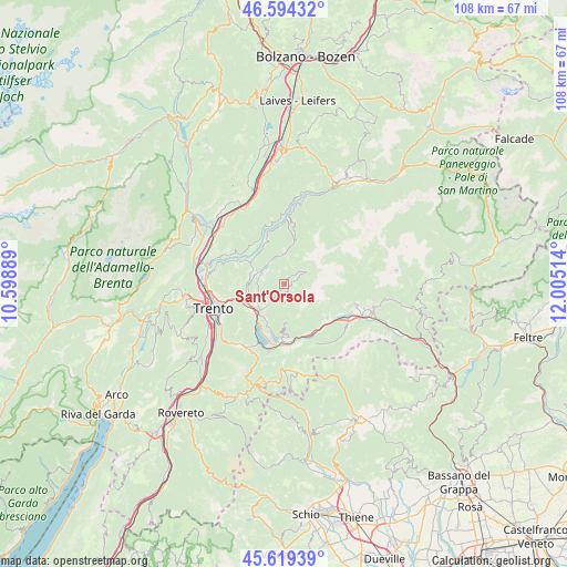
Sant'Orsola GPS coordinates[2]
46° 6' 32.436" North, 11° 18' 7.236" East
| Map corner | latitude | longitude |
|---|---|---|
| Upper-left | 46.59432°, | 10.59889° |
| Center: | 46.10901°, | 11.30201° |
| Lower-right: | 45.61939°, | 12.00514° |
| Map W x H: | 108.4×108.4 km | = 67.4×67.4mi |
| max Lat: | 47.04031° ⇑5.8% North |
| Sant'Orsola: | 46.10901° |
| min Lat: | ⇓94.2% South 35.50142° |
| min Long | Sant'Orsola | max Long |
| 6.69888° | 11.30201° | 18.48682° |
| W 46.9%⇐ | ⇒53.1% E |
Elevation
Elevation of Sant'Orsola is 957 m = 3140 ft, and this is 650.3 m = 2134 ft above average elevation for this country.
| Max E: |
2085 m = 6841 ft | 3.6% |
| Sant'Orsola | 957 m 3140 ft | |
| Avg. | 306.7 m = 1006 ft | |
Min E: |
-4 m = -13 ft | 96.4% |
See also: Italy elevation on elevation.city.
Geographical zone
Sant'Orsola is located in North temperate zone (between Tropic of Cancer and the Arctic Circle). Distance of this North polar circle is 2274.3 km =1413.2 mi to North.| Distance of | km | miles | from Sant'Orsola |
|---|---|---|---|
| North Pole | 4880.2 | 3032.4 | to North |
| Arctic Circle | 2274.3 | 1413.2 | to North |
| Tropic Cancer | 2520.9 | 1566.4 | to South |
| Equator | 5126.8 | 3185.6 | to South |


Nearby cities:
15 places around Sant'Orsola: (largest is in red/bold)
• Baselga di Pinè
5 km =3.1 mi,  301°
301°
• Canezza
3.9 km =2.4 mi,  209°
209°
• Centrale
5.8 km =3.6 mi,  0°
0°
• Fierozzo
1.3 km =0.8 mi,  78°
78°
• Fornace
7.4 km =4.6 mi,  277°
277°
• Frassilongo
2.2 km =1.4 mi,  189°
189°
• Lases
7.6 km =4.7 mi, 302°
• Lona-Lases
7.5 km =4.7 mi, 301°
• Madrano-Canzolino
7.1 km =4.4 mi,  247°
247°
• Miola di Pinè
4.6 km =2.9 mi, 295°
• Palù del Fersina
4.4 km =2.7 mi,  58°
58°
• Pergine Valsugana
7 km =4.3 mi,  225°
225°
• Rizzolaga-Campolongo
5 km =3.1 mi,  332°
332°
• Sant'Orsola Terme
0 km =0 mi,  127°
127°
• Vignola
7.4 km =4.6 mi, 194°
Sources, notices
• [Note1] Compared only with cities in Italy existing in our database
• [Src1] Map data: © OpenStreetMap contributors (CC-BY-SA)
• [Src2] Other city data from geonames.org with taken over terms of usage.
• [Src3] Geographical zone / Annual Mean Temperature by Robert A. Rohde @ Wikipedia
