Vallo della Lucania geodata
Vallo della Lucania (Campania) is a seat of a third-order administrative division; located in Italy in Europe/Rome (GMT+2) time zone. With population of 6,899 people, there are 1412 cities with bigger population in this country. Compared to other cities in Italy, 86.2% of cities are located further ↑North; 89.3% of cities are located further ←West and 70.6% of cities have lower elevation than Vallo della Lucania. Note1
Administrative division(s):
- Level 1: Campania
- Level 2: Provincia di Salerno
- Level 3: Vallo della Lucania


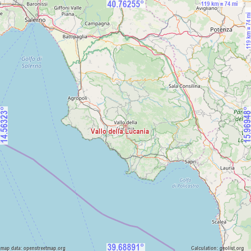
Vallo della Lucania GPS coordinates[2]
40° 13' 40.296" North, 15° 15' 58.86" East
| Map corner | latitude | longitude |
|---|---|---|
| Upper-left | 40.76255°, | 14.56323° |
| Center: | 40.22786°, | 15.26635° |
| Lower-right: | 39.68891°, | 15.96948° |
| Map W x H: | 119.4×119.4 km | = 74.2×74.2mi |
| max Lat: | 47.04031° ⇑86.2% North |
| Vallo della Lucania: | 40.22786° |
| min Lat: | ⇓13.8% South 35.50142° |
| min Long | Vallo della Luc | max Long |
| 6.69888° | 15.26635° | 18.48682° |
| W 89.3%⇐ | ⇒10.7% E |
Elevation
Elevation of Vallo della Lucania is 400 m = 1312 ft, and this is 93.3 m = 306 ft above average elevation for this country.
| Max E: |
2085 m = 6841 ft | 29.4% |
| Vallo della Lucania | 400 m 1312 ft | |
| Avg. | 306.7 m = 1006 ft | |
Min E: |
-4 m = -13 ft | 70.6% |
See also: Italy elevation on elevation.city.
Geographical zone
Vallo della Lucania is located in North temperate zone (between Tropic of Cancer and the Arctic Circle). Distance of this Northern Tropic circle is 1867 km =1160.1 mi to South.| Distance of | km | miles | from Vallo della Lucania |
|---|---|---|---|
| North Pole | 5534.1 | 3438.7 | to North |
| Arctic Circle | 2928.3 | 1819.6 | to North |
| Tropic Cancer | 1867 | 1160.1 | to South |
| Equator | 4472.9 | 2779.3 | to South |


Nearby cities:
15 places around Vallo della Lucania: (largest is in red/bold)
• Campora
8.9 km =5.5 mi,  14°
14°
• Cannalonga
2.9 km =1.8 mi,  50°
50°
• Cardile
5.1 km =3.2 mi,  337°
337°
• Castelnuovo Cilento
7.6 km =4.7 mi,  262°
262°
• Ceraso
3.8 km =2.4 mi,  193°
193°
• Cuccaro Vetere
7.9 km =4.9 mi,  154°
154°
• Futani
9.8 km =6.1 mi, 150°
• Gioi
8 km =5 mi,  329°
329°
• Moio della Civitella-Pellare
2.1 km =1.3 mi, 5°
• Novi Velia
1.8 km =1.1 mi,  109°
109°
• Salento
6.9 km =4.3 mi,  289°
289°
• Salicuneta
8.4 km =5.2 mi,  248°
248°
• Santa Barbara
5.5 km =3.4 mi, 187°
• Stio
9.2 km =5.7 mi,  352°
352°
• Velina
9.4 km =5.8 mi, 252°
Sources, notices
• [Note1] Compared only with cities in Italy existing in our database
• [Src1] Map data: © OpenStreetMap contributors (CC-BY-SA)
• [Src2] Other city data from geonames.org with taken over terms of usage.
• [Src3] Geographical zone / Annual Mean Temperature by Robert A. Rohde @ Wikipedia
