Tassullo geodata
Tassullo (Trentino-Alto Adige) is a seat of a third-order administrative division; located in Italy in Europe/Rome (GMT+2) time zone. With population of 1,554 people, there are 4997 cities with bigger population in this country. Compared to other cities in Italy, 97.2% of cities are located further ↓South; 56.6% of cities are located further →East and 85% of cities have lower elevation than Tassullo. Note1
Administrative division(s):
- Level 1: Trentino-Alto Adige
- Level 2: Provincia autonoma di Trento
- Level 3: Ville d'Anaunia


Tassullo GPS coordinates[2]
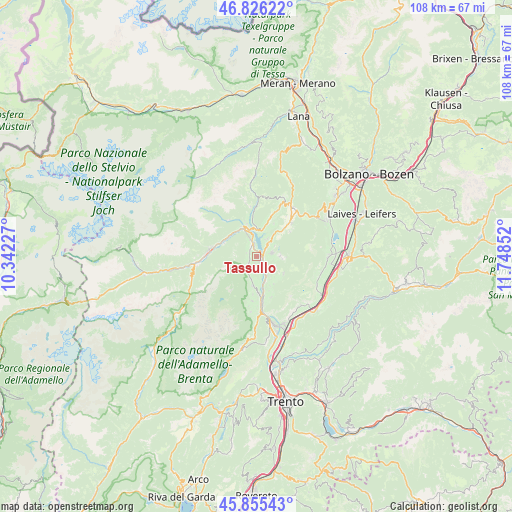
46° 20' 34.728" North, 11° 2' 43.404" East
| Map corner | latitude | longitude |
|---|---|---|
| Upper-left | 46.82622°, | 10.34227° |
| Center: | 46.34298°, | 11.04539° |
| Lower-right: | 45.85543°, | 11.74852° |
| Map W x H: | 107.9×107.9 km | = 67×67mi |
| max Lat: | 47.04031° ⇑2.8% North |
| Tassullo: | 46.34298° |
| min Lat: | ⇓97.2% South 35.50142° |
| min Long | Tassullo | max Long |
| 6.69888° | 11.04539° | 18.48682° |
| W 43.4%⇐ | ⇒56.6% E |
Elevation
Elevation of Tassullo is 612 m = 2008 ft, and this is 305.3 m = 1002 ft above average elevation for this country.
| Max E: |
2085 m = 6841 ft | 15% |
| Tassullo | 612 m 2008 ft | |
| Avg. | 306.7 m = 1006 ft | |
Min E: |
-4 m = -13 ft | 85% |
See also: Italy elevation on elevation.city.
Geographical zone
Tassullo is located in North temperate zone (between Tropic of Cancer and the Arctic Circle). Distance of this North polar circle is 2248.3 km =1397 mi to North.| Distance of | km | miles | from Tassullo |
|---|---|---|---|
| North Pole | 4854.2 | 3016.3 | to North |
| Arctic Circle | 2248.3 | 1397 | to North |
| Tropic Cancer | 2546.9 | 1582.6 | to South |
| Equator | 5152.9 | 3201.9 | to South |


Nearby cities:
15 places around Tassullo: (largest is in red/bold)
• Cagnò
5.7 km =3.5 mi,  356°
356°
• Cles
2.4 km =1.5 mi,  336°
336°
• Coredo
3.5 km =2.2 mi,  78°
78°
• Flavon
5.1 km =3.2 mi,  193°
193°
• Nanno
3.1 km =1.9 mi,  177°
177°
• Revò
5.6 km =3.5 mi,  10°
10°
• Romallo
6.2 km =3.9 mi, 14°
• Sanzeno
3.5 km =2.2 mi,  41°
41°
• Segno
4.7 km =2.9 mi,  151°
151°
• Sfruz
6 km =3.7 mi,  93°
93°
• Smarano
4.9 km =3 mi, 89°
• Taio
2.9 km =1.8 mi, 146°
• Terres
4.1 km =2.5 mi,  204°
204°
• Tres
4.6 km =2.9 mi,  120°
120°
• Tuenno
2.4 km =1.5 mi,  226°
226°
Sources, notices
• [Note1] Compared only with cities in Italy existing in our database
• [Src1] Map data: © OpenStreetMap contributors (CC-BY-SA)
• [Src2] Other city data from geonames.org with taken over terms of usage.
• [Src3] Geographical zone / Annual Mean Temperature by Robert A. Rohde @ Wikipedia
