Segno geodata
Segno (Trentino-Alto Adige) is a populated place; located in Italy in Europe/Rome (GMT+2) time zone. With population of 651 people, there are 8629 cities with bigger population in this country. Compared to other cities in Italy, 96.9% of cities are located further ↓South; 56.2% of cities are located further →East and 80.1% of cities have lower elevation than Segno. Note1
Administrative division(s):
- Level 1: Trentino-Alto Adige
- Level 2: Provincia autonoma di Trento
- Level 3: Predaia


Segno GPS coordinates[2]
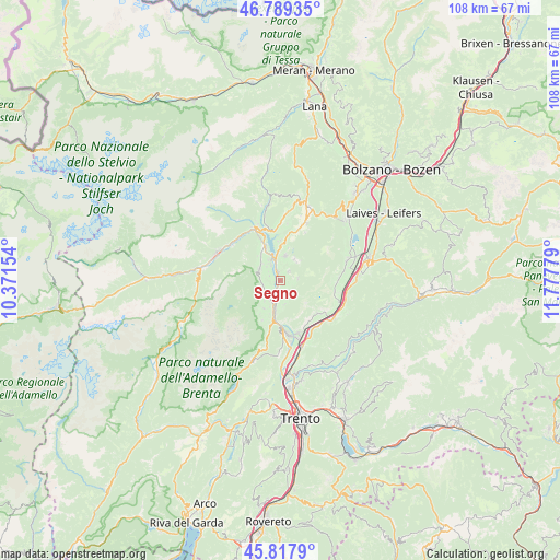
46° 18' 20.808" North, 11° 4' 28.776" East
| Map corner | latitude | longitude |
|---|---|---|
| Upper-left | 46.78935°, | 10.37154° |
| Center: | 46.30578°, | 11.07466° |
| Lower-right: | 45.8179°, | 11.77779° |
| Map W x H: | 108×108 km | = 67.1×67.1mi |
| max Lat: | 47.04031° ⇑3.1% North |
| Segno: | 46.30578° |
| min Lat: | ⇓96.9% South 35.50142° |
| min Long | Segno | max Long |
| 6.69888° | 11.07466° | 18.48682° |
| W 43.8%⇐ | ⇒56.2% E |
Elevation
Elevation of Segno is 527 m = 1729 ft, and this is 220.3 m = 723 ft above average elevation for this country.
| Max E: |
2085 m = 6841 ft | 19.9% |
| Segno | 527 m 1729 ft | |
| Avg. | 306.7 m = 1006 ft | |
Min E: |
-4 m = -13 ft | 80.1% |
See also: Italy elevation on elevation.city.
Geographical zone
Segno is located in North temperate zone (between Tropic of Cancer and the Arctic Circle). Distance of this North polar circle is 2252.5 km =1399.6 mi to North.| Distance of | km | miles | from Segno |
|---|---|---|---|
| North Pole | 4858.3 | 3018.8 | to North |
| Arctic Circle | 2252.5 | 1399.6 | to North |
| Tropic Cancer | 2542.8 | 1580 | to South |
| Equator | 5148.7 | 3199.3 | to South |


Nearby cities:
15 places around Segno: (largest is in red/bold)
• Campodenno
6.2 km =3.9 mi,  210°
210°
• Coredo
5 km =3.1 mi,  13°
13°
• Cunevo
3.8 km =2.4 mi,  235°
235°
• Denno
4 km =2.5 mi, 209°
• Flavon
3.5 km =2.2 mi,  256°
256°
• Nanno
2.3 km =1.4 mi,  295°
295°
• Sfruz
5.3 km =3.3 mi,  45°
45°
• Smarano
4.9 km =3 mi,  33°
33°
• Taio
1.9 km =1.2 mi,  339°
339°
• Tassullo
4.7 km =2.9 mi,  331°
331°
• Terres
4 km =2.5 mi,  276°
276°
• Tres
2.4 km =1.5 mi,  43°
43°
• Tuenno
4.7 km =2.9 mi, 302°
• Vervò
3.5 km =2.2 mi,  82°
82°
• Vigo di Ton
4.6 km =2.9 mi,  167°
167°
Sources, notices
• [Note1] Compared only with cities in Italy existing in our database
• [Src1] Map data: © OpenStreetMap contributors (CC-BY-SA)
• [Src2] Other city data from geonames.org with taken over terms of usage.
• [Src3] Geographical zone / Annual Mean Temperature by Robert A. Rohde @ Wikipedia
