Striano geodata
Striano (Campania) is a seat of a third-order administrative division; located in Italy in Europe/Rome (GMT+2) time zone. With population of 7,639 people, there are 1277 cities with bigger population in this country. Compared to other cities in Italy, 81.2% of cities are located further ↑North; 83.4% of cities are located further ←West and 86.7% of cities have higher elevation than Striano. Note1


Striano GPS coordinates[2]
40° 48' 55.548" North, 14° 34' 31.224" East
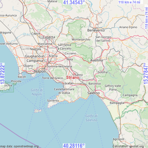
| Map corner | latitude | longitude |
|---|---|---|
| Upper-left | 41.34543°, | 13.87222° |
| Center: | 40.81543°, | 14.57534° |
| Lower-right: | 40.28116°, | 15.27847° |
| Map W x H: | 118.3×118.3 km | = 73.5×73.5mi |
| max Lat: | 47.04031° ⇑81.2% North |
| Striano: | 40.81543° |
| min Lat: | ⇓18.8% South 35.50142° |
| min Long | Striano | max Long |
| 6.69888° | 14.57534° | 18.48682° |
| W 83.4%⇐ | ⇒16.6% E |
Elevation
Elevation of Striano is 26 m = 85 ft, and this is 280.7 m = 921 ft below average elevation for this country.
| Max E: |
2085 m = 6841 ft | 86.7% |
| Avg. | 306.7 m = 1006 ft | |
| Striano | 26 m = 85 ft | |
Min E: |
-4 m = -13 ft | 13.3% |
See also: Italy elevation on elevation.city.
Geographical zone
Striano is located in North temperate zone (between Tropic of Cancer and the Arctic Circle). Distance of this Northern Tropic circle is 1932.3 km =1200.7 mi to South.| Distance of | km | miles | from Striano |
|---|---|---|---|
| North Pole | 5468.8 | 3398.2 | to North |
| Arctic Circle | 2862.9 | 1778.9 | to North |
| Tropic Cancer | 1932.3 | 1200.7 | to South |
| Equator | 4538.3 | 2820 | to South |


Nearby cities:
15 places around Striano: (largest is in red/bold)
• Carbonara di Nola
6.6 km =4.1 mi,  2°
2°
• Domicella
7.3 km =4.5 mi,  7°
7°
• Fornillo
4.7 km =2.9 mi,  246°
246°
• Palma Campania
6 km =3.7 mi,  340°
340°
• Poggiomarino
3.3 km =2.1 mi,  241°
241°
• Ponte San Michele
2 km =1.2 mi,  43°
43°
• San Gennaro Vesuviano
6.8 km =4.2 mi,  320°
320°
• San Giuseppe Vesuviano
6.3 km =3.9 mi,  290°
290°
• San Lorenzo
6.9 km =4.3 mi,  169°
169°
• San Marzano sul Sarno
4.2 km =2.6 mi, 174°
• San Valentino Torio
3.6 km =2.2 mi,  138°
138°
• Sarno
4 km =2.5 mi,  102°
102°
• Scafati
6.9 km =4.3 mi,  207°
207°
• Terzigno
7 km =4.3 mi,  259°
259°
• Vico
6.5 km =4 mi,  354°
354°
Sources, notices
• [Note1] Compared only with cities in Italy existing in our database
• [Src1] Map data: © OpenStreetMap contributors (CC-BY-SA)
• [Src2] Other city data from geonames.org with taken over terms of usage.
• [Src3] Geographical zone / Annual Mean Temperature by Robert A. Rohde @ Wikipedia
