Soprabolzano geodata
Soprabolzano (Trentino-Alto Adige) is a populated place; located in Italy in Europe/Rome (GMT+2) time zone. With population of 1,043 people, there are 6489 cities with bigger population in this country. Compared to other cities in Italy, 98.5% of cities are located further ↓South; 51.8% of cities are located further →East and 98.8% of cities have lower elevation than Soprabolzano. Note1


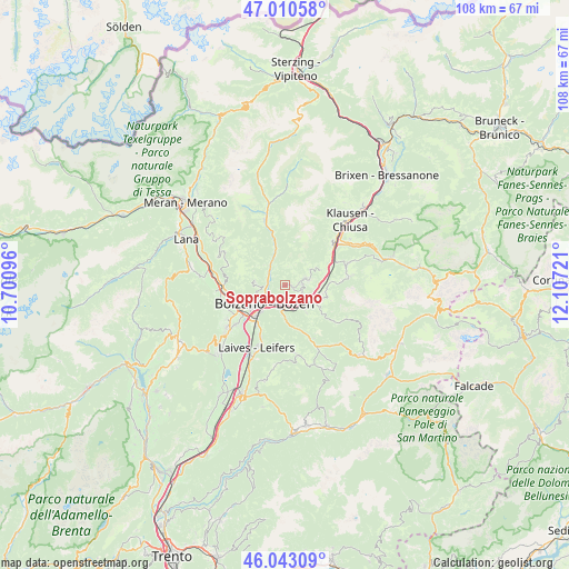
Soprabolzano GPS coordinates[2]
46° 31' 44.364" North, 11° 24' 14.688" East
| Map corner | latitude | longitude |
|---|---|---|
| Upper-left | 47.01058°, | 10.70096° |
| Center: | 46.52899°, | 11.40408° |
| Lower-right: | 46.04309°, | 12.10721° |
| Map W x H: | 107.6×107.6 km | = 66.9×66.9mi |
| max Lat: | 47.04031° ⇑1.5% North |
| Soprabolzano: | 46.52899° |
| min Lat: | ⇓98.5% South 35.50142° |
| min Long | Soprabolzano | max Long |
| 6.69888° | 11.40408° | 18.48682° |
| W 48.2%⇐ | ⇒51.8% E |
Elevation
Elevation of Soprabolzano is 1225 m = 4019 ft, and this is 918.3 m = 3013 ft above average elevation for this country.
| Max E: |
2085 m = 6841 ft | 1.2% |
| Soprabolzano | 1225 m 4019 ft | |
| Avg. | 306.7 m = 1006 ft | |
Min E: |
-4 m = -13 ft | 98.8% |
See also: Italy elevation on elevation.city.
Geographical zone
Soprabolzano is located in North temperate zone (between Tropic of Cancer and the Arctic Circle). Distance of this North polar circle is 2227.6 km =1384.2 mi to North.| Distance of | km | miles | from Soprabolzano |
|---|---|---|---|
| North Pole | 4833.5 | 3003.4 | to North |
| Arctic Circle | 2227.6 | 1384.2 | to North |
| Tropic Cancer | 2567.6 | 1595.4 | to South |
| Equator | 5173.5 | 3214.7 | to South |


Nearby cities:
15 places around Soprabolzano: (largest is in red/bold)
• Auna di Sotto
3.4 km =2.1 mi,  123°
123°
• Bolzano
6.5 km =4 mi,  229°
229°
• Cardano
4.1 km =2.5 mi,  192°
192°
• Collalbo
4.4 km =2.7 mi,  74°
74°
• Collepietra
6.2 km =3.9 mi,  141°
141°
• Cornaiano
11.9 km =7.4 mi, 232°
• Cornedo All'Isarco
4.4 km =2.7 mi,  177°
177°
• Fiè Allo Sciliar
7.6 km =4.7 mi,  100°
100°
• Pineta
10.8 km =6.7 mi,  203°
203°
• Renon - Ritten
4.3 km =2.7 mi, 71°
• San Genesio Atesino
5.7 km =3.5 mi,  276°
276°
• San Giacomo
9.7 km =6 mi,  213°
213°
• Settequerce
10.8 km =6.7 mi,  259°
259°
• Siusi
11.9 km =7.4 mi,  83°
83°
• Tires
11.6 km =7.2 mi,  125°
125°
Sources, notices
• [Note1] Compared only with cities in Italy existing in our database
• [Src1] Map data: © OpenStreetMap contributors (CC-BY-SA)
• [Src2] Other city data from geonames.org with taken over terms of usage.
• [Src3] Geographical zone / Annual Mean Temperature by Robert A. Rohde @ Wikipedia
