Saviore geodata
Saviore (Lombardy) is a seat of a third-order administrative division; located in Italy in Europe/Rome (GMT+2) time zone. With population of 339 people, there are 10516 cities with bigger population in this country. Compared to other cities in Italy, 93.7% of cities are located further ↓South; 64% of cities are located further →East and 98.9% of cities have lower elevation than Saviore. Note1
Administrative division(s):
- Level 1: Lombardy
- Level 2: Provincia di Brescia
- Level 3: Saviore dell'Adamello


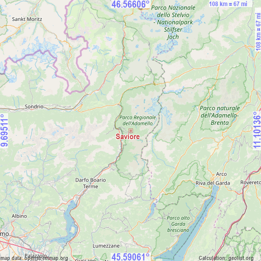
Saviore GPS coordinates[2]
46° 4' 49.764" North, 10° 23' 53.628" East
| Map corner | latitude | longitude |
|---|---|---|
| Upper-left | 46.56606°, | 9.69511° |
| Center: | 46.08049°, | 10.39823° |
| Lower-right: | 45.59061°, | 11.10136° |
| Map W x H: | 108.5×108.5 km | = 67.4×67.4mi |
| max Lat: | 47.04031° ⇑6.3% North |
| Saviore: | 46.08049° |
| min Lat: | ⇓93.7% South 35.50142° |
| min Long | Saviore | max Long |
| 6.69888° | 10.39823° | 18.48682° |
| W 36%⇐ | ⇒64% E |
Elevation
Elevation of Saviore is 1234 m = 4049 ft, and this is 927.3 m = 3042 ft above average elevation for this country.
| Max E: |
2085 m = 6841 ft | 1.1% |
| Saviore | 1234 m 4049 ft | |
| Avg. | 306.7 m = 1006 ft | |
Min E: |
-4 m = -13 ft | 98.9% |
See also: Italy elevation on elevation.city.
Geographical zone
Saviore is located in North temperate zone (between Tropic of Cancer and the Arctic Circle). Distance of this North polar circle is 2277.5 km =1415.2 mi to North.| Distance of | km | miles | from Saviore |
|---|---|---|---|
| North Pole | 4883.4 | 3034.4 | to North |
| Arctic Circle | 2277.5 | 1415.2 | to North |
| Tropic Cancer | 2517.8 | 1564.5 | to South |
| Equator | 5123.7 | 3183.7 | to South |


Nearby cities:
15 places around Saviore: (largest is in red/bold)
• Badetto
10.2 km =6.3 mi,  204°
204°
• Berzo
5.2 km =3.2 mi,  285°
285°
• Capo di Ponte
7.1 km =4.4 mi,  217°
217°
• Cedegolo
3.7 km =2.3 mi,  258°
258°
• Ceto
9.4 km =5.8 mi, 202°
• Cevo
2.2 km =1.4 mi,  271°
271°
• Cimbergo
6.8 km =4.2 mi, 201°
• Demo
4.5 km =2.8 mi,  279°
279°
• Malonno
7.7 km =4.8 mi,  306°
306°
• Ono San Pietro
8.9 km =5.5 mi, 217°
• Paisco Loveno
8.2 km =5.1 mi, 268°
• Paspardo
5.8 km =3.6 mi, 202°
• Sellero
5.1 km =3.2 mi,  230°
230°
• Sonico
10.2 km =6.3 mi,  339°
339°
• Valle
2.7 km =1.7 mi,  117°
117°
Sources, notices
• [Note1] Compared only with cities in Italy existing in our database
• [Src1] Map data: © OpenStreetMap contributors (CC-BY-SA)
• [Src2] Other city data from geonames.org with taken over terms of usage.
• [Src3] Geographical zone / Annual Mean Temperature by Robert A. Rohde @ Wikipedia
