Santa Croce geodata
Santa Croce (Friuli Venezia Giulia) is a populated place; located in Italy in Europe/Rome (GMT+2) time zone. With population of 1,248 people, there are 5795 cities with bigger population in this country. Compared to other cities in Italy, 82.8% of cities are located further ↓South; 75.5% of cities are located further ←West and 54.3% of cities have higher elevation than Santa Croce. Note1
Administrative division(s):
- Level 1: Friuli Venezia Giulia
- Level 2: Provincia di Trieste
- Level 3: Trieste


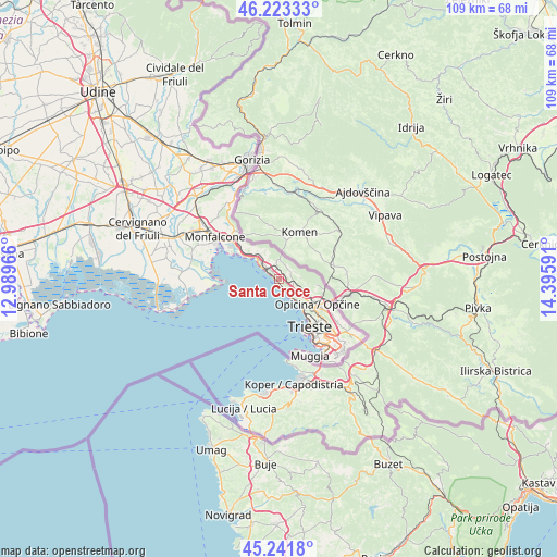
Santa Croce GPS coordinates[2]
45° 44' 4.992" North, 13° 41' 34.008" East
| Map corner | latitude | longitude |
|---|---|---|
| Upper-left | 46.22333°, | 12.98966° |
| Center: | 45.73472°, | 13.69278° |
| Lower-right: | 45.2418°, | 14.39591° |
| Map W x H: | 109.1×109.1 km | = 67.8×67.8mi |
| max Lat: | 47.04031° ⇑17.2% North |
| Santa Croce: | 45.73472° |
| min Lat: | ⇓82.8% South 35.50142° |
| min Long | Santa Croce | max Long |
| 6.69888° | 13.69278° | 18.48682° |
| W 75.5%⇐ | ⇒24.5% E |
Elevation
Elevation of Santa Croce is 207 m = 679 ft, and this is 99.7 m = 327 ft below average elevation for this country.
| Max E: |
2085 m = 6841 ft | 54.3% |
| Avg. | 306.7 m = 1006 ft | |
| Santa Croce | 207 m = 679 ft | |
Min E: |
-4 m = -13 ft | 45.7% |
See also: Italy elevation on elevation.city.
Geographical zone
Santa Croce is located in North temperate zone (between Tropic of Cancer and the Arctic Circle). Distance of this North polar circle is 2315.9 km =1439 mi to North.| Distance of | km | miles | from Santa Croce |
|---|---|---|---|
| North Pole | 4921.8 | 3058.3 | to North |
| Arctic Circle | 2315.9 | 1439 | to North |
| Tropic Cancer | 2479.3 | 1540.6 | to South |
| Equator | 5085.2 | 3159.8 | to South |


Nearby cities:
15 places around Santa Croce: (largest is in red/bold)
• Aurisina
2.2 km =1.4 mi,  317°
317°
• Aurisina Cave
3.4 km =2.1 mi,  309°
309°
• Duino
8.1 km =5 mi,  302°
302°
• Monfalcone
14.6 km =9.1 mi, 302°
• Muggia
15.6 km =9.7 mi,  158°
158°
• Padriciano
14.2 km =8.8 mi,  126°
126°
• Prosecco-Contovello
4.3 km =2.7 mi, 132°
• Repen
7.7 km =4.8 mi,  99°
99°
• Sgonico
4.2 km =2.6 mi,  88°
88°
• Sistiana-Visogliano
6 km =3.7 mi, 314°
• Staranzano
16.6 km =10.3 mi, 296°
• Trebiciano
12.4 km =7.7 mi,  123°
123°
• Trieste
11.5 km =7.1 mi,  145°
145°
• Villa Opicina
9.1 km =5.7 mi, 125°
• Zolla
9.3 km =5.8 mi, 102°
Sources, notices
• [Note1] Compared only with cities in Italy existing in our database
• [Src1] Map data: © OpenStreetMap contributors (CC-BY-SA)
• [Src2] Other city data from geonames.org with taken over terms of usage.
• [Src3] Geographical zone / Annual Mean Temperature by Robert A. Rohde @ Wikipedia
