Muggia geodata
Muggia (Friuli Venezia Giulia) is a seat of a third-order administrative division; located in Italy in Europe/Rome (GMT+2) time zone. With population of 10,929 people, there are 868 cities with bigger population in this country. Compared to other cities in Italy, 77.3% of cities are located further ↓South; 76.3% of cities are located further ←West and 95.9% of cities have higher elevation than Muggia. Note1
Administrative division(s):
- Level 1: Friuli Venezia Giulia
- Level 2: Provincia di Trieste
- Level 3: Muggia


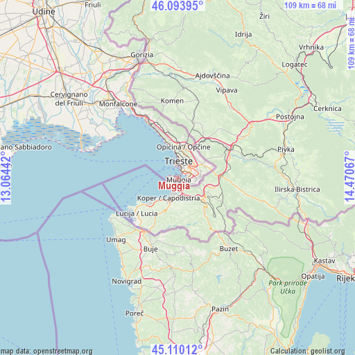
Muggia GPS coordinates[2]
45° 36' 15.084" North, 13° 46' 3.144" East
| Map corner | latitude | longitude |
|---|---|---|
| Upper-left | 46.09395°, | 13.06442° |
| Center: | 45.60419°, | 13.76754° |
| Lower-right: | 45.11012°, | 14.47067° |
| Map W x H: | 109.4×109.4 km | = 68×68mi |
| max Lat: | 47.04031° ⇑22.7% North |
| Muggia: | 45.60419° |
| min Lat: | ⇓77.3% South 35.50142° |
| min Long | Muggia | max Long |
| 6.69888° | 13.76754° | 18.48682° |
| W 76.3%⇐ | ⇒23.7% E |
Elevation
Elevation of Muggia is 7 m = 23 ft, and this is 299.7 m = 983 ft below average elevation for this country.
| Max E: |
2085 m = 6841 ft | 95.9% |
| Avg. | 306.7 m = 1006 ft | |
| Muggia | 7 m = 23 ft | |
Min E: |
-4 m = -13 ft | 4.1% |
See also: Italy elevation on elevation.city.
Geographical zone
Muggia is located in North temperate zone (between Tropic of Cancer and the Arctic Circle). Distance of this North polar circle is 2330.5 km =1448.1 mi to North.| Distance of | km | miles | from Muggia |
|---|---|---|---|
| North Pole | 4936.4 | 3067.3 | to North |
| Arctic Circle | 2330.5 | 1448.1 | to North |
| Tropic Cancer | 2464.8 | 1531.6 | to South |
| Equator | 5070.7 | 3150.8 | to South |


Nearby cities:
15 places around Muggia: (largest is in red/bold)
• Aurisina
17.8 km =11.1 mi,  335°
335°
• Aurisina Cave
18.7 km =11.6 mi,  333°
333°
• Basovizza
8.5 km =5.3 mi,  60°
60°
• Dolina
7.1 km =4.4 mi,  93°
93°
• Domio
5 km =3.1 mi,  81°
81°
• Padriciano
8.2 km =5.1 mi,  42°
42°
• Prosecco-Contovello
11.8 km =7.3 mi,  347°
347°
• Repen
13.3 km =8.3 mi,  7°
7°
• Santa Croce
15.6 km =9.7 mi, 338°
• Sgonico
14.7 km =9.1 mi, 353°
• Sistiana-Visogliano
21.2 km =13.2 mi, 331°
• Trebiciano
8.8 km =5.5 mi,  30°
30°
• Trieste
5.1 km =3.2 mi, 8°
• Villa Opicina
9.4 km =5.8 mi, 9°
• Zolla
13 km =8.1 mi, 14°
Sources, notices
• [Note1] Compared only with cities in Italy existing in our database
• [Src1] Map data: © OpenStreetMap contributors (CC-BY-SA)
• [Src2] Other city data from geonames.org with taken over terms of usage.
• [Src3] Geographical zone / Annual Mean Temperature by Robert A. Rohde @ Wikipedia
