San Martino Buon Albergo geodata
San Martino Buon Albergo (Veneto) is a seat of a third-order administrative division; located in Italy in Europe/Rome (GMT+2) time zone. With population of 11,818 people, there are 788 cities with bigger population in this country. Compared to other cities in Italy, 70.9% of cities are located further ↓South; 56% of cities are located further →East and 80.9% of cities have higher elevation than San Martino Buon Albergo. Note1
Administrative division(s):
- Level 1: Veneto
- Level 2: Provincia di Verona
- Level 3: San Martino Buon Albergo
Current local time in San Martino Buon Albergo:
09:58 PM, WednesdayDifference from your time zone: hours


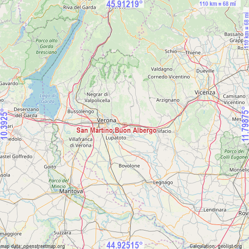
San Martino Buon Albergo GPS coordinates[2]
45° 25' 14.988" North, 11° 5' 44.232" East
| Map corner | latitude | longitude |
|---|---|---|
| Upper-left | 45.91219°, | 10.3925° |
| Center: | 45.42083°, | 11.09562° |
| Lower-right: | 44.92515°, | 11.79875° |
| Map W x H: | 109.7×109.7 km | = 68.2×68.2mi |
| max Lat: | 47.04031° ⇑29.1% North |
| San Martino Buon Albergo: | 45.42083° |
| min Lat: | ⇓70.9% South 35.50142° |
| min Long | San Martino Buo | max Long |
| 6.69888° | 11.09562° | 18.48682° |
| W 44%⇐ | ⇒56% E |
Elevation
Elevation of San Martino Buon Albergo is 46 m = 151 ft, and this is 260.7 m = 855 ft below average elevation for this country.
| Max E: |
2085 m = 6841 ft | 80.9% |
| Avg. | 306.7 m = 1006 ft | |
| San Martino Buon Albergo | 46 m = 151 ft | |
Min E: |
-4 m = -13 ft | 19.1% |
See also: Italy elevation on elevation.city.
Geographical zone
San Martino Buon Albergo is located in North temperate zone (between Tropic of Cancer and the Arctic Circle). Distance of this North polar circle is 2350.9 km =1460.8 mi to North.| Distance of | km | miles | from San Martino Buon Albergo |
|---|---|---|---|
| North Pole | 4956.7 | 3079.9 | to North |
| Arctic Circle | 2350.9 | 1460.8 | to North |
| Tropic Cancer | 2444.4 | 1518.9 | to South |
| Equator | 5050.3 | 3138.1 | to South |


Nearby cities:
15 places around San Martino Buon Albergo: (largest is in red/bold)
• Caldierino-Rota
4.8 km =3 mi,  96°
96°
• Caldiero
6.4 km =4 mi, 96°
• Lavagno
3.6 km =2.2 mi,  56°
56°
• Marcellise
4.6 km =2.9 mi,  10°
10°
• Mizzole
7 km =4.3 mi,  336°
336°
• Monticelli-Fontana
3.4 km =2.1 mi,  73°
73°
• Montorio
4.8 km =3 mi,  330°
330°
• San Briccio
4.2 km =2.6 mi,  25°
25°
• San Felice
6.4 km =4 mi,  312°
312°
• San Giovanni Lupatoto
5.9 km =3.7 mi,  222°
222°
• San Pancrazio
5.7 km =3.5 mi,  274°
274°
• San Pietro
3.6 km =2.2 mi,  48°
48°
• Strà-Montanara-Pieve
4.8 km =3 mi,  86°
86°
• Vago
2.7 km =1.7 mi, 92°
• Zevio
6 km =3.7 mi,  154°
154°
Sources, notices
• [Note1] Compared only with cities in Italy existing in our database
• [Src1] Map data: © OpenStreetMap contributors (CC-BY-SA)
• [Src2] Other city data from geonames.org with taken over terms of usage.
• [Src3] Geographical zone / Annual Mean Temperature by Robert A. Rohde @ Wikipedia
