Monticelli-Fontana geodata
Monticelli-Fontana (Veneto) is a populated place; located in Italy in Europe/Rome (GMT+2) time zone. With population of 1,321 people, there are 5564 cities with bigger population in this country. Compared to other cities in Italy, 71.2% of cities are located further ↓South; 55.3% of cities are located further →East and 79.3% of cities have higher elevation than Monticelli-Fontana. Note1


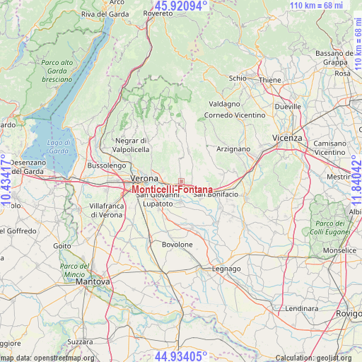
Monticelli-Fontana GPS coordinates[2]
45° 25' 46.74" North, 11° 8' 14.244" East
| Map corner | latitude | longitude |
|---|---|---|
| Upper-left | 45.92094°, | 10.43417° |
| Center: | 45.42965°, | 11.13729° |
| Lower-right: | 44.93405°, | 11.84042° |
| Map W x H: | 109.7×109.7 km | = 68.2×68.2mi |
| max Lat: | 47.04031° ⇑28.8% North |
| Monticelli-Fontana: | 45.42965° |
| min Lat: | ⇓71.2% South 35.50142° |
| min Long | Monticelli-Font | max Long |
| 6.69888° | 11.13729° | 18.48682° |
| W 44.7%⇐ | ⇒55.3% E |
Elevation
Elevation of Monticelli-Fontana is 53 m = 174 ft, and this is 253.7 m = 832 ft below average elevation for this country.
| Max E: |
2085 m = 6841 ft | 79.3% |
| Avg. | 306.7 m = 1006 ft | |
| Monticelli-Fontana | 53 m = 174 ft | |
Min E: |
-4 m = -13 ft | 20.7% |
See also: Italy elevation on elevation.city.
Geographical zone
Monticelli-Fontana is located in North temperate zone (between Tropic of Cancer and the Arctic Circle). Distance of this North polar circle is 2349.9 km =1460.2 mi to North.| Distance of | km | miles | from Monticelli-Fontana |
|---|---|---|---|
| North Pole | 4955.8 | 3079.4 | to North |
| Arctic Circle | 2349.9 | 1460.2 | to North |
| Tropic Cancer | 2445.4 | 1519.5 | to South |
| Equator | 5051.3 | 3138.7 | to South |


Nearby cities:
15 places around Monticelli-Fontana: (largest is in red/bold)
• Caldierino-Rota
2.1 km =1.3 mi,  134°
134°
• Caldiero
3.6 km =2.2 mi,  118°
118°
• Colognola ai Colli
3.7 km =2.3 mi,  83°
83°
• Illasi
5.4 km =3.4 mi,  40°
40°
• Lavagno
1 km =0.6 mi,  346°
346°
• Marcellise
4.3 km =2.7 mi,  325°
325°
• Mezzane di Sotto
5.9 km =3.7 mi, 352°
• Montorio
6.4 km =4 mi,  299°
299°
• San Briccio
3.1 km =1.9 mi, 333°
• San Martino Buon Albergo
3.4 km =2.1 mi,  253°
253°
• San Pietro
1.5 km =0.9 mi,  336°
336°
• San Vittore
6.6 km =4.1 mi,  90°
90°
• Strà-Montanara-Pieve
1.7 km =1.1 mi,  112°
112°
• Vago
1.2 km =0.7 mi,  206°
206°
• Zevio
6.4 km =4 mi,  185°
185°
Sources, notices
• [Note1] Compared only with cities in Italy existing in our database
• [Src1] Map data: © OpenStreetMap contributors (CC-BY-SA)
• [Src2] Other city data from geonames.org with taken over terms of usage.
• [Src3] Geographical zone / Annual Mean Temperature by Robert A. Rohde @ Wikipedia
