Rezzato geodata
Rezzato (Lombardy) is a seat of a third-order administrative division; located in Italy in Europe/Rome (GMT+2) time zone. With population of 12,779 people, there are 720 cities with bigger population in this country. Compared to other cities in Italy, 74% of cities are located further ↓South; 64.9% of cities are located further →East and 62.4% of cities have higher elevation than Rezzato. Note1


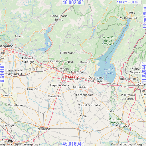
Rezzato GPS coordinates[2]
45° 30' 42.552" North, 10° 19' 2.316" East
| Map corner | latitude | longitude |
|---|---|---|
| Upper-left | 46.00239°, | 9.61418° |
| Center: | 45.51182°, | 10.31731° |
| Lower-right: | 45.01694°, | 11.02044° |
| Map W x H: | 109.6×109.6 km | = 68.1×68.1mi |
| max Lat: | 47.04031° ⇑26% North |
| Rezzato: | 45.51182° |
| min Lat: | ⇓74% South 35.50142° |
| min Long | Rezzato | max Long |
| 6.69888° | 10.31731° | 18.48682° |
| W 35.1%⇐ | ⇒64.9% E |
Elevation
Elevation of Rezzato is 146 m = 479 ft, and this is 160.7 m = 527 ft below average elevation for this country.
| Max E: |
2085 m = 6841 ft | 62.4% |
| Avg. | 306.7 m = 1006 ft | |
| Rezzato | 146 m = 479 ft | |
Min E: |
-4 m = -13 ft | 37.6% |
See also: Italy elevation on elevation.city.
Geographical zone
Rezzato is located in North temperate zone (between Tropic of Cancer and the Arctic Circle). Distance of this North polar circle is 2340.7 km =1454.4 mi to North.| Distance of | km | miles | from Rezzato |
|---|---|---|---|
| North Pole | 4946.6 | 3073.7 | to North |
| Arctic Circle | 2340.7 | 1454.4 | to North |
| Tropic Cancer | 2454.5 | 1525.2 | to South |
| Equator | 5060.4 | 3144.4 | to South |


Nearby cities:
15 places around Rezzato: (largest is in red/bold)
• Bettole
4.4 km =2.7 mi,  236°
236°
• Borgosatollo
7.1 km =4.4 mi, 237°
• Botticino
2.1 km =1.3 mi,  345°
345°
• Buffalora-Bettole
3.7 km =2.3 mi, 243°
• Campagnola
7.6 km =4.7 mi,  113°
113°
• Capodimonte
6.4 km =4 mi,  219°
219°
• Castenedolo
4.6 km =2.9 mi,  205°
205°
• Mazzano
3 km =1.9 mi,  72°
72°
• Molinetto
3.8 km =2.4 mi,  121°
121°
• Nuvolento
6.7 km =4.2 mi,  55°
55°
• Nuvolera
4.6 km =2.9 mi, 60°
• Paitone
8 km =5 mi, 55°
• Patuzza
4.8 km =3 mi,  88°
88°
• San Gallo
5.7 km =3.5 mi, 352°
• Serle
6.8 km =4.2 mi,  35°
35°
Sources, notices
• [Note1] Compared only with cities in Italy existing in our database
• [Src1] Map data: © OpenStreetMap contributors (CC-BY-SA)
• [Src2] Other city data from geonames.org with taken over terms of usage.
• [Src3] Geographical zone / Annual Mean Temperature by Robert A. Rohde @ Wikipedia
