Pomezia geodata
Pomezia (Latium) is a seat of a third-order administrative division; located in Italy in Europe/Rome (GMT+2) time zone. With population of 22,346 people, there are 391 cities with bigger population in this country. Compared to other cities in Italy, 73.3% of cities are located further ↑North; 62.4% of cities are located further ←West and 69.3% of cities have higher elevation than Pomezia. Note1
Administrative division(s):
- Level 1: Latium
- Level 2: Città metropolitana di Roma Capitale
- Level 3: Pomezia


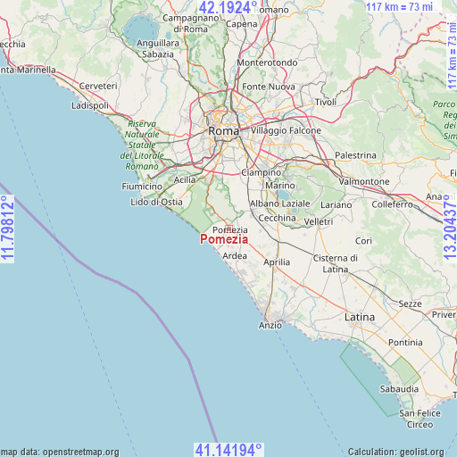
Pomezia GPS coordinates[2]
41° 40' 9.516" North, 12° 30' 4.464" East
| Map corner | latitude | longitude |
|---|---|---|
| Upper-left | 42.1924°, | 11.79812° |
| Center: | 41.66931°, | 12.50124° |
| Lower-right: | 41.14194°, | 13.20437° |
| Map W x H: | 116.8×116.8 km | = 72.6×72.6mi |
| max Lat: | 47.04031° ⇑73.3% North |
| Pomezia: | 41.66931° |
| min Lat: | ⇓26.7% South 35.50142° |
| min Long | Pomezia | max Long |
| 6.69888° | 12.50124° | 18.48682° |
| W 62.4%⇐ | ⇒37.6% E |
Elevation
Elevation of Pomezia is 101 m = 331 ft, and this is 205.7 m = 675 ft below average elevation for this country.
| Max E: |
2085 m = 6841 ft | 69.3% |
| Avg. | 306.7 m = 1006 ft | |
| Pomezia | 101 m = 331 ft | |
Min E: |
-4 m = -13 ft | 30.7% |
See also: Italy elevation on elevation.city.
Geographical zone
Pomezia is located in North temperate zone (between Tropic of Cancer and the Arctic Circle). Distance of this Northern Tropic circle is 2027.3 km =1259.7 mi to South.| Distance of | km | miles | from Pomezia |
|---|---|---|---|
| North Pole | 5373.9 | 3339.2 | to North |
| Arctic Circle | 2768 | 1720 | to North |
| Tropic Cancer | 2027.3 | 1259.7 | to South |
| Equator | 4633.2 | 2878.9 | to South |


Nearby cities:
15 places around Pomezia: (largest is in red/bold)
• Ardea
7.7 km =4.8 mi,  154°
154°
• Area Produttiva
1.5 km =0.9 mi,  18°
18°
• Campo Jemini
4.8 km =3 mi,  168°
168°
• Caronti
4.3 km =2.7 mi,  129°
129°
• Casalazzara
8.1 km =5 mi, 129°
• Colle del Pino
8.1 km =5 mi,  357°
357°
• Colli di Enea
1.8 km =1.1 mi,  210°
210°
• Mantiglia di Ardea
9.4 km =5.8 mi,  84°
84°
• Monte Migliore La Selvotta
5.7 km =3.5 mi,  0°
0°
• Santa Palomba-Roma II
6.9 km =4.3 mi,  56°
56°
• Sedici Pini-La Macchiozza
2.5 km =1.6 mi, 210°
• Spregamore
8.5 km =5.3 mi,  29°
29°
• Stazione di Pavona-Palazzo Margana
9.2 km =5.7 mi,  53°
53°
• Torvaianica
6.3 km =3.9 mi, 211°
• Torvaianica Alta
4.2 km =2.6 mi,  184°
184°
Sources, notices
• [Note1] Compared only with cities in Italy existing in our database
• [Src1] Map data: © OpenStreetMap contributors (CC-BY-SA)
• [Src2] Other city data from geonames.org with taken over terms of usage.
• [Src3] Geographical zone / Annual Mean Temperature by Robert A. Rohde @ Wikipedia
