Santa Palomba-Roma II geodata
Santa Palomba-Roma II (Latium) is a populated place; located in Italy in Europe/Rome (GMT+2) time zone. With population of 600 people, there are 9006 cities with bigger population in this country. Compared to other cities in Italy, 72.8% of cities are located further ↑North; 63.2% of cities are located further ←West and 65.6% of cities have higher elevation than Santa Palomba-Roma II. Note1
Administrative division(s):
- Level 1: Latium
- Level 2: Città metropolitana di Roma Capitale
- Level 3: Pomezia
Current local time in Santa Palomba-Roma II:
03:08 PM, WednesdayDifference from your time zone: hours


Santa Palomba-Roma II GPS coordinates[2]
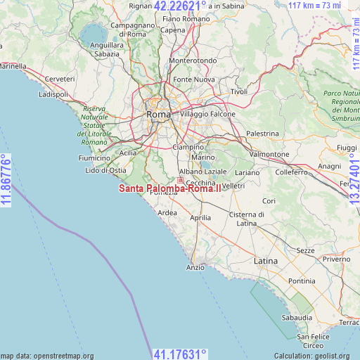
41° 42' 12.24" North, 12° 34' 15.168" East
| Map corner | latitude | longitude |
|---|---|---|
| Upper-left | 42.22621°, | 11.86776° |
| Center: | 41.7034°, | 12.57088° |
| Lower-right: | 41.17631°, | 13.27401° |
| Map W x H: | 116.7×116.7 km | = 72.5×72.5mi |
| max Lat: | 47.04031° ⇑72.8% North |
| Santa Palomba-Roma II: | 41.7034° |
| min Lat: | ⇓27.2% South 35.50142° |
| min Long | Santa Palomba-R | max Long |
| 6.69888° | 12.57088° | 18.48682° |
| W 63.2%⇐ | ⇒36.8% E |
Elevation
Elevation of Santa Palomba-Roma II is 124 m = 407 ft, and this is 182.7 m = 599 ft below average elevation for this country.
| Max E: |
2085 m = 6841 ft | 65.6% |
| Avg. | 306.7 m = 1006 ft | |
| Santa Palomba-Roma II | 124 m = 407 ft | |
Min E: |
-4 m = -13 ft | 34.4% |
See also: Italy elevation on elevation.city.
Geographical zone
Santa Palomba-Roma II is located in North temperate zone (between Tropic of Cancer and the Arctic Circle). Distance of this Northern Tropic circle is 2031.1 km =1262.1 mi to South.| Distance of | km | miles | from Santa Palomba-Roma II |
|---|---|---|---|
| North Pole | 5370.1 | 3336.8 | to North |
| Arctic Circle | 2764.2 | 1717.6 | to North |
| Tropic Cancer | 2031.1 | 1262.1 | to South |
| Equator | 4637 | 2881.3 | to South |


Nearby cities:
15 places around Santa Palomba-Roma II: (largest is in red/bold)
• Albano Laziale
7.8 km =4.8 mi,  69°
69°
• Area Produttiva
5.8 km =3.6 mi,  245°
245°
• Borgo Lotti
6.9 km =4.3 mi,  348°
348°
• Cancelliera-Massimetta-Pantanelle
3.3 km =2.1 mi,  91°
91°
• Caronti
7 km =4.3 mi,  200°
200°
• Castel Gandolfo
8.3 km =5.2 mi,  52°
52°
• Castel di Leva
8.4 km =5.2 mi, 345°
• Cecchina
6.5 km =4 mi, 91°
• Colle del Pino
7.6 km =4.7 mi,  305°
305°
• Mantiglia di Ardea
4.7 km =2.9 mi,  129°
129°
• Monte Migliore La Selvotta
6 km =3.7 mi,  288°
288°
• Pavona
4.6 km =2.9 mi,  56°
56°
• Pomezia
6.9 km =4.3 mi,  236°
236°
• Spregamore
4 km =2.5 mi,  336°
336°
• Stazione di Pavona-Palazzo Margana
2.3 km =1.4 mi,  43°
43°
Sources, notices
• [Note1] Compared only with cities in Italy existing in our database
• [Src1] Map data: © OpenStreetMap contributors (CC-BY-SA)
• [Src2] Other city data from geonames.org with taken over terms of usage.
• [Src3] Geographical zone / Annual Mean Temperature by Robert A. Rohde @ Wikipedia
