Area Produttiva geodata
Area Produttiva (Latium) is a populated place; located in Italy in Europe/Rome (GMT+1) time zone. With population of 2,234 people, there are 3827 cities with bigger population in this country. Compared to other cities in Italy, 73.1% of cities are located further ↑North; 62.4% of cities are located further ←West and 68.8% of cities have higher elevation than Area Produttiva. Note1
Administrative division(s):
- Level 1: Latium
- Level 2: Città metropolitana di Roma Capitale
- Level 3: Pomezia


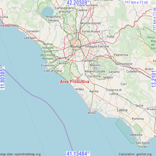
Area Produttiva GPS coordinates[2]
41° 40' 55.596" North, 12° 30' 25.092" East
| Map corner | latitude | longitude |
|---|---|---|
| Upper-left | 42.20509°, | 11.80385° |
| Center: | 41.68211°, | 12.50697° |
| Lower-right: | 41.15484°, | 13.2101° |
| Map W x H: | 116.8×116.8 km | = 72.6×72.6mi |
| max Lat: | 47.04031° ⇑73.1% North |
| Area Produttiva: | 41.68211° |
| min Lat: | ⇓26.9% South 35.50142° |
| min Long | Area Produttiva | max Long |
| 6.69888° | 12.50697° | 18.48682° |
| W 62.4%⇐ | ⇒37.6% E |
Elevation
Elevation of Area Produttiva is 104 m = 341 ft, and this is 202.7 m = 665 ft below average elevation for this country.
| Max E: |
2085 m = 6841 ft | 68.8% |
| Avg. | 306.7 m = 1006 ft | |
| Area Produttiva | 104 m = 341 ft | |
Min E: |
-4 m = -13 ft | 31.2% |
See also: Italy elevation on elevation.city.
Geographical zone
Area Produttiva is located in North temperate zone (between Tropic of Cancer and the Arctic Circle). Distance of this Northern Tropic circle is 2028.7 km =1260.6 mi to South.| Distance of | km | miles | from Area Produttiva |
|---|---|---|---|
| North Pole | 5372.4 | 3338.3 | to North |
| Arctic Circle | 2766.6 | 1719.1 | to North |
| Tropic Cancer | 2028.7 | 1260.6 | to South |
| Equator | 4634.6 | 2879.8 | to South |


Nearby cities:
15 places around Area Produttiva: (largest is in red/bold)
• Ardea
8.8 km =5.5 mi,  160°
160°
• Campo Jemini
6.1 km =3.8 mi,  175°
175°
• Cancelliera-Massimetta-Pantanelle
8.9 km =5.5 mi,  74°
74°
• Caronti
5 km =3.1 mi,  145°
145°
• Casalazzara
8.7 km =5.4 mi,  138°
138°
• Colle del Pino
6.8 km =4.2 mi,  352°
352°
• Colli di Enea
3.3 km =2.1 mi,  205°
205°
• Monte Migliore La Selvotta
4.3 km =2.7 mi, 354°
• Pomezia
1.5 km =0.9 mi,  198°
198°
• Santa Palomba-Roma II
5.8 km =3.6 mi, 65°
• Sedici Pini-La Macchiozza
4 km =2.5 mi, 205°
• Spregamore
7.1 km =4.4 mi,  31°
31°
• Stazione di Pavona-Palazzo Margana
8 km =5 mi,  59°
59°
• Torvaianica
7.7 km =4.8 mi, 208°
• Torvaianica Alta
5.7 km =3.5 mi,  187°
187°
Sources, notices
• [Note1] Compared only with cities in Italy existing in our database
• [Src1] Map data: © OpenStreetMap contributors (CC-BY-SA)
• [Src2] Other city data from geonames.org with taken over terms of usage.
• [Src3] Geographical zone / Annual Mean Temperature by Robert A. Rohde @ Wikipedia
