Piazza al Serchio-San Michele geodata
Piazza al Serchio-San Michele (Tuscany) is a seat of a third-order administrative division; located in Italy in Europe/Rome (GMT+2) time zone. With population of 1,071 people, there are 6401 cities with bigger population in this country. Compared to other cities in Italy, 52.9% of cities are located further ↑North; 65.1% of cities are located further →East and 79.3% of cities have lower elevation than Piazza al Serchio-San Michele. Note1
Current local time in Piazza al Serchio-San Michele:
10:12 PM, WednesdayDifference from your time zone: hours


Piazza al Serchio-San Michele GPS coordinates[2]
44° 11' 4.38" North, 10° 17' 48.804" East
| Map corner | latitude | longitude |
|---|---|---|
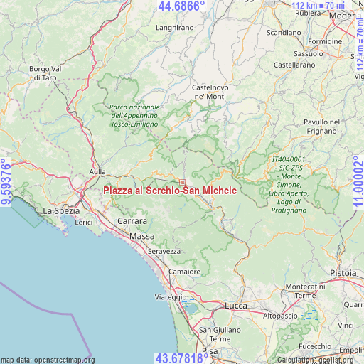
| Upper-left | 44.6866°, | 9.59376° |
| Center: | 44.18455°, | 10.29689° |
| Lower-right: | 43.67818°, | 11.00002° |
| Map W x H: | 112.1×112.1 km | = 69.7×69.7mi |
| max Lat: | 47.04031° ⇑52.9% North |
| Piazza al Serchio-San Michele: | 44.18455° |
| min Lat: | ⇓47.1% South 35.50142° |
| min Long | Piazza al Serch | max Long |
| 6.69888° | 10.29689° | 18.48682° |
| W 34.9%⇐ | ⇒65.1% E |
Elevation
Elevation of Piazza al Serchio-San Michele is 513 m = 1683 ft, and this is 206.3 m = 677 ft above average elevation for this country.
| Max E: |
2085 m = 6841 ft | 20.7% |
| Piazza al Serchio-San Michele | 513 m 1683 ft | |
| Avg. | 306.7 m = 1006 ft | |
Min E: |
-4 m = -13 ft | 79.3% |
See also: Italy elevation on elevation.city.
Geographical zone
Piazza al Serchio-San Michele is located in North temperate zone (between Tropic of Cancer and the Arctic Circle). Distance of this Northern Tropic circle is 2306.9 km =1433.4 mi to South.| Distance of | km | miles | from Piazza al Serchio-San Michele |
|---|---|---|---|
| North Pole | 5094.2 | 3165.4 | to North |
| Arctic Circle | 2488.3 | 1546.2 | to North |
| Tropic Cancer | 2306.9 | 1433.4 | to South |
| Equator | 4912.9 | 3052.7 | to South |


Nearby cities:
15 places around Piazza al Serchio-San Michele: (largest is in red/bold)
• Camporgiano
4 km =2.5 mi,  134°
134°
• Careggine
7.5 km =4.7 mi,  162°
162°
• Casola in Lunigiana
9.7 km =6 mi,  280°
280°
• Castelnuovo di Garfagnana
11.8 km =7.3 mi, 132°
• Castiglione di Garfagnana
9.9 km =6.2 mi,  111°
111°
• Fontana delle Monache
8 km =5 mi,  190°
190°
• Giuncugnano
4.9 km =3 mi,  306°
306°
• Gorfigliano
5.8 km =3.6 mi,  222°
222°
• Minucciano
7.3 km =4.5 mi,  257°
257°
• Monzone
13.7 km =8.5 mi, 260°
• Pieve Fosciana
10.8 km =6.7 mi,  123°
123°
• San Romano
4.2 km =2.6 mi, 111°
• San Romano in Garfagnana
4.3 km =2.7 mi, 112°
• Sillano
4.3 km =2.7 mi,  5°
5°
• Villa Collemandina
8.5 km =5.3 mi, 109°
In other languages:
- In France: Piazza al Serchio
- In German: Piazza al Serchio
- In Italian: Piazza al Serchio
Sources, notices
• [Note1] Compared only with cities in Italy existing in our database
• [Src1] Map data: © OpenStreetMap contributors (CC-BY-SA)
• [Src2] Other city data from geonames.org with taken over terms of usage.
• [Src3] Geographical zone / Annual Mean Temperature by Robert A. Rohde @ Wikipedia
