Sillano geodata
Sillano (Tuscany) is a seat of a third-order administrative division; located in Italy in Europe/Rome (GMT+2) time zone. With population of 352 people, there are 10472 cities with bigger population in this country. Compared to other cities in Italy, 52.6% of cities are located further ↑North; 65% of cities are located further →East and 91.8% of cities have lower elevation than Sillano. Note1
Administrative division(s):
- Level 1: Tuscany
- Level 2: Provincia di Lucca
- Level 3: Sillano Giuncugnano


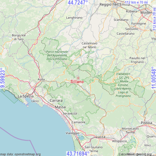
Sillano GPS coordinates[2]
44° 13' 22.728" North, 10° 18' 8.46" East
| Map corner | latitude | longitude |
|---|---|---|
| Upper-left | 44.7247°, | 9.59923° |
| Center: | 44.22298°, | 10.30235° |
| Lower-right: | 43.71694°, | 11.00548° |
| Map W x H: | 112.1×112.1 km | = 69.7×69.7mi |
| max Lat: | 47.04031° ⇑52.6% North |
| Sillano: | 44.22298° |
| min Lat: | ⇓47.4% South 35.50142° |
| min Long | Sillano | max Long |
| 6.69888° | 10.30235° | 18.48682° |
| W 35%⇐ | ⇒65% E |
Elevation
Elevation of Sillano is 764 m = 2507 ft, and this is 457.3 m = 1500 ft above average elevation for this country.
| Max E: |
2085 m = 6841 ft | 8.2% |
| Sillano | 764 m 2507 ft | |
| Avg. | 306.7 m = 1006 ft | |
Min E: |
-4 m = -13 ft | 91.8% |
See also: Italy elevation on elevation.city.
Geographical zone
Sillano is located in North temperate zone (between Tropic of Cancer and the Arctic Circle). Distance of this Northern Tropic circle is 2311.2 km =1436.1 mi to South.| Distance of | km | miles | from Sillano |
|---|---|---|---|
| North Pole | 5089.9 | 3162.7 | to North |
| Arctic Circle | 2484 | 1543.5 | to North |
| Tropic Cancer | 2311.2 | 1436.1 | to South |
| Equator | 4917.1 | 3055.3 | to South |


Nearby cities:
15 places around Sillano: (largest is in red/bold)
• Camporgiano
7.5 km =4.7 mi,  160°
160°
• Careggine
11.6 km =7.2 mi,  170°
170°
• Casola in Lunigiana
10.3 km =6.4 mi,  255°
255°
• Castiglione di Garfagnana
11.7 km =7.3 mi,  131°
131°
• Collagna
14 km =8.7 mi,  350°
350°
• Fontana delle Monache
12.3 km =7.6 mi,  188°
188°
• Giuncugnano
4.6 km =2.9 mi,  252°
252°
• Gorfigliano
9.6 km =6 mi,  206°
206°
• Ligonchio
10.9 km =6.8 mi,  17°
17°
• Minucciano
9.5 km =5.9 mi,  231°
231°
• Piazza al Serchio-San Michele
4.3 km =2.7 mi, 185°
• Pieve Fosciana
13.4 km =8.3 mi,  140°
140°
• San Romano
6.8 km =4.2 mi,  149°
149°
• San Romano in Garfagnana
6.9 km =4.3 mi, 149°
• Villa Collemandina
10.4 km =6.5 mi, 133°
Sources, notices
• [Note1] Compared only with cities in Italy existing in our database
• [Src1] Map data: © OpenStreetMap contributors (CC-BY-SA)
• [Src2] Other city data from geonames.org with taken over terms of usage.
• [Src3] Geographical zone / Annual Mean Temperature by Robert A. Rohde @ Wikipedia
