Villa Collemandina geodata
Villa Collemandina (Tuscany) is a seat of a third-order administrative division; located in Italy in Europe/Rome (GMT+2) time zone. With population of 139 people, there are 11319 cities with bigger population in this country. Compared to other cities in Italy, 53.2% of cities are located further ↑North; 64% of cities are located further →East and 81.5% of cities have lower elevation than Villa Collemandina. Note1
Administrative division(s):
- Level 1: Tuscany
- Level 2: Provincia di Lucca
- Level 3: Villa Collemandina


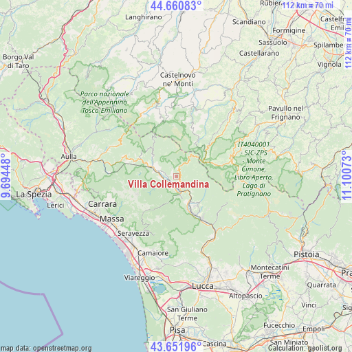
Villa Collemandina GPS coordinates[2]
44° 9' 30.78" North, 10° 23' 51.36" East
| Map corner | latitude | longitude |
|---|---|---|
| Upper-left | 44.66083°, | 9.69448° |
| Center: | 44.15855°, | 10.3976° |
| Lower-right: | 43.65196°, | 11.10073° |
| Map W x H: | 112.2×112.2 km | = 69.7×69.7mi |
| max Lat: | 47.04031° ⇑53.2% North |
| Villa Collemandina: | 44.15855° |
| min Lat: | ⇓46.8% South 35.50142° |
| min Long | Villa Collemand | max Long |
| 6.69888° | 10.3976° | 18.48682° |
| W 36%⇐ | ⇒64% E |
Elevation
Elevation of Villa Collemandina is 546 m = 1791 ft, and this is 239.3 m = 785 ft above average elevation for this country.
| Max E: |
2085 m = 6841 ft | 18.5% |
| Villa Collemandina | 546 m 1791 ft | |
| Avg. | 306.7 m = 1006 ft | |
Min E: |
-4 m = -13 ft | 81.5% |
See also: Italy elevation on elevation.city.
Geographical zone
Villa Collemandina is located in North temperate zone (between Tropic of Cancer and the Arctic Circle). Distance of this Northern Tropic circle is 2304.1 km =1431.7 mi to South.| Distance of | km | miles | from Villa Collemandina |
|---|---|---|---|
| North Pole | 5097.1 | 3167.2 | to North |
| Arctic Circle | 2491.2 | 1548 | to North |
| Tropic Cancer | 2304.1 | 1431.7 | to South |
| Equator | 4910 | 3050.9 | to South |


Nearby cities:
15 places around Villa Collemandina: (largest is in red/bold)
• Barga
11.5 km =7.1 mi,  145°
145°
• Camporgiano
5.2 km =3.2 mi,  270°
270°
• Careggine
7.2 km =4.5 mi,  233°
233°
• Castelnuovo di Garfagnana
5.1 km =3.2 mi,  173°
173°
• Castelvecchio Pascoli
10 km =6.2 mi, 148°
• Castiglione di Garfagnana
1.3 km =0.8 mi,  120°
120°
• Fontana delle Monache
10.7 km =6.6 mi,  242°
242°
• Fosciandora
6.9 km =4.3 mi,  134°
134°
• Gallicano
11.7 km =7.3 mi,  162°
162°
• Molazzana
9.8 km =6.1 mi, 170°
• Piazza al Serchio-San Michele
8.5 km =5.3 mi,  289°
289°
• Pieve Fosciana
3.2 km =2 mi, 162°
• San Romano
4.3 km =2.7 mi, 287°
• San Romano in Garfagnana
4.2 km =2.6 mi, 286°
• Sillano
10.4 km =6.5 mi,  313°
313°
Sources, notices
• [Note1] Compared only with cities in Italy existing in our database
• [Src1] Map data: © OpenStreetMap contributors (CC-BY-SA)
• [Src2] Other city data from geonames.org with taken over terms of usage.
• [Src3] Geographical zone / Annual Mean Temperature by Robert A. Rohde @ Wikipedia
