Pianazzo geodata
Pianazzo (Lombardy) is a seat of a third-order administrative division; located in Italy in Europe/Rome (GMT+2) time zone. With population of 69 people, there are 11540 cities with bigger population in this country. Compared to other cities in Italy, 97.9% of cities are located further ↓South; 75.6% of cities are located further →East and 99.5% of cities have lower elevation than Pianazzo. Note1


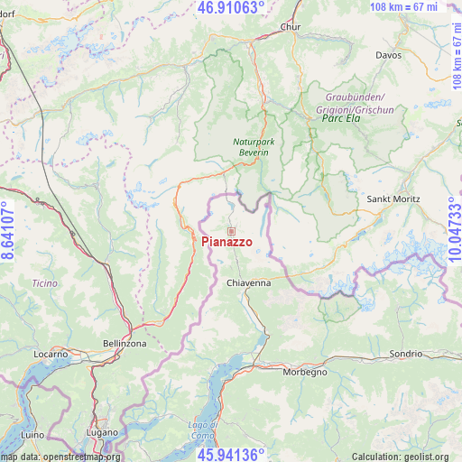
Pianazzo GPS coordinates[2]
46° 25' 41.34" North, 9° 20' 39.12" East
| Map corner | latitude | longitude |
|---|---|---|
| Upper-left | 46.91063°, | 8.64107° |
| Center: | 46.42815°, | 9.3442° |
| Lower-right: | 45.94136°, | 10.04733° |
| Map W x H: | 107.8×107.8 km | = 67×67mi |
| max Lat: | 47.04031° ⇑2.1% North |
| Pianazzo: | 46.42815° |
| min Lat: | ⇓97.9% South 35.50142° |
| min Long | Pianazzo | max Long |
| 6.69888° | 9.3442° | 18.48682° |
| W 24.4%⇐ | ⇒75.6% E |
Elevation
Elevation of Pianazzo is 1405 m = 4610 ft, and this is 1098.3 m = 3603 ft above average elevation for this country.
| Max E: |
2085 m = 6841 ft | 0.5% |
| Pianazzo | 1405 m 4610 ft | |
| Avg. | 306.7 m = 1006 ft | |
Min E: |
-4 m = -13 ft | 99.5% |
See also: Italy elevation on elevation.city.
Geographical zone
Pianazzo is located in North temperate zone (between Tropic of Cancer and the Arctic Circle). Distance of this North polar circle is 2238.8 km =1391.1 mi to North.| Distance of | km | miles | from Pianazzo |
|---|---|---|---|
| North Pole | 4844.7 | 3010.4 | to North |
| Arctic Circle | 2238.8 | 1391.1 | to North |
| Tropic Cancer | 2556.4 | 1588.5 | to South |
| Equator | 5162.3 | 3207.7 | to South |


Nearby cities:
15 places around Pianazzo: (largest is in red/bold)
• Borgonuovo
13.2 km =8.2 mi,  146°
146°
• Campodolcino
2.9 km =1.8 mi,  168°
168°
• Chiavenna
12.7 km =7.9 mi,  160°
160°
• Gordona
15.3 km =9.5 mi, 173°
• Menarola
14.4 km =8.9 mi, 174°
• Mese
14.1 km =8.8 mi, 169°
• Piuro
12.4 km =7.7 mi, 151°
• Prata Camportaccio
14 km =8.7 mi, 163°
• Prata Centro
13.9 km =8.6 mi, 163°
• Prosto
12.5 km =7.8 mi, 151°
• San Cassiano
17.3 km =10.7 mi, 166°
• San Giacomo Filippo
10.3 km =6.4 mi, 168°
• San Vittore
13.7 km =8.5 mi, 167°
• Villa
15.3 km =9.5 mi,  135°
135°
• Villa di Chiavenna
15.1 km =9.4 mi, 135°
Sources, notices
• [Note1] Compared only with cities in Italy existing in our database
• [Src1] Map data: © OpenStreetMap contributors (CC-BY-SA)
• [Src2] Other city data from geonames.org with taken over terms of usage.
• [Src3] Geographical zone / Annual Mean Temperature by Robert A. Rohde @ Wikipedia
