Piana Crixia geodata
Piana Crixia (Liguria) is a seat of a third-order administrative division; located in Italy in Europe/Rome (GMT+2) time zone. With population of 816 people, there are 7564 cities with bigger population in this country. Compared to other cities in Italy, 50.8% of cities are located further ↓South; 90% of cities are located further →East and 55.7% of cities have lower elevation than Piana Crixia. Note1


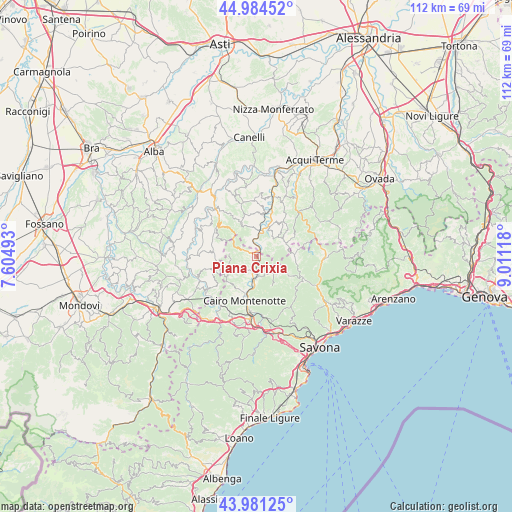
Piana Crixia GPS coordinates[2]
44° 29' 6.144" North, 8° 18' 28.98" East
| Map corner | latitude | longitude |
|---|---|---|
| Upper-left | 44.98452°, | 7.60493° |
| Center: | 44.48504°, | 8.30805° |
| Lower-right: | 43.98125°, | 9.01118° |
| Map W x H: | 111.6×111.6 km | = 69.3×69.3mi |
| max Lat: | 47.04031° ⇑49.2% North |
| Piana Crixia: | 44.48504° |
| min Lat: | ⇓50.8% South 35.50142° |
| min Long | Piana Crixia | max Long |
| 6.69888° | 8.30805° | 18.48682° |
| W 10%⇐ | ⇒90% E |
Elevation
Elevation of Piana Crixia is 270 m = 886 ft, and this is 36.7 m = 120 ft below average elevation for this country.
| Max E: |
2085 m = 6841 ft | 44.3% |
| Avg. | 306.7 m = 1006 ft | |
| Piana Crixia | 270 m = 886 ft | |
Min E: |
-4 m = -13 ft | 55.7% |
See also: Italy elevation on elevation.city.
Geographical zone
Piana Crixia is located in North temperate zone (between Tropic of Cancer and the Arctic Circle). Distance of this Northern Tropic circle is 2340.4 km =1454.3 mi to South.| Distance of | km | miles | from Piana Crixia |
|---|---|---|---|
| North Pole | 5060.8 | 3144.6 | to North |
| Arctic Circle | 2454.9 | 1525.4 | to North |
| Tropic Cancer | 2340.4 | 1454.3 | to South |
| Equator | 4946.3 | 3073.5 | to South |


Nearby cities:
15 places around Piana Crixia: (largest is in red/bold)
• Cairo Montenotte
10 km =6.2 mi,  193°
193°
• Castelletto Uzzone
9.6 km =6 mi,  276°
276°
• Dego
4.5 km =2.8 mi,  180°
180°
• Giusvalla
8 km =5 mi,  121°
121°
• Gottasecca
11.5 km =7.1 mi,  256°
256°
• Merana
3.8 km =2.4 mi,  348°
348°
• Mioglia
8.5 km =5.3 mi,  84°
84°
• Molino-Pera
0.3 km =0.2 mi,  12°
12°
• Mombaldone
9.7 km =6 mi, 11°
• Pareto
6.8 km =4.2 mi,  59°
59°
• Pezzolo Valle Uzzone
10.8 km =6.7 mi,  303°
303°
• Pontinvrea
11.2 km =7 mi, 115°
• Rocchetta Cairo
6.2 km =3.9 mi, 186°
• Serole
8.6 km =5.3 mi,  333°
333°
• Spigno Monferrato
6.8 km =4.2 mi,  17°
17°
Sources, notices
• [Note1] Compared only with cities in Italy existing in our database
• [Src1] Map data: © OpenStreetMap contributors (CC-BY-SA)
• [Src2] Other city data from geonames.org with taken over terms of usage.
• [Src3] Geographical zone / Annual Mean Temperature by Robert A. Rohde @ Wikipedia
