Pessinetto geodata
Pessinetto (Piedmont) is a seat of a third-order administrative division; located in Italy in Europe/Rome (GMT+2) time zone. With population of 456 people, there are 10067 cities with bigger population in this country. Compared to other cities in Italy, 67.1% of cities are located further ↓South; 98.3% of cities are located further →East and 84.9% of cities have lower elevation than Pessinetto. Note1


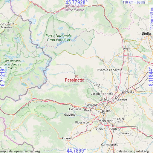
Pessinetto GPS coordinates[2]
45° 17' 12.3" North, 7° 24' 55.116" East
| Map corner | latitude | longitude |
|---|---|---|
| Upper-left | 45.77928°, | 6.71219° |
| Center: | 45.28675°, | 7.41531° |
| Lower-right: | 44.7899°, | 8.11844° |
| Map W x H: | 110×110 km | = 68.4×68.4mi |
| max Lat: | 47.04031° ⇑32.9% North |
| Pessinetto: | 45.28675° |
| min Lat: | ⇓67.1% South 35.50142° |
| min Long | Pessinetto | max Long |
| 6.69888° | 7.41531° | 18.48682° |
| W 1.7%⇐ | ⇒98.3% E |
Elevation
Elevation of Pessinetto is 610 m = 2001 ft, and this is 303.3 m = 995 ft above average elevation for this country.
| Max E: |
2085 m = 6841 ft | 15.1% |
| Pessinetto | 610 m 2001 ft | |
| Avg. | 306.7 m = 1006 ft | |
Min E: |
-4 m = -13 ft | 84.9% |
See also: Italy elevation on elevation.city.
Geographical zone
Pessinetto is located in North temperate zone (between Tropic of Cancer and the Arctic Circle). Distance of this North polar circle is 2365.8 km =1470 mi to North.| Distance of | km | miles | from Pessinetto |
|---|---|---|---|
| North Pole | 4971.6 | 3089.2 | to North |
| Arctic Circle | 2365.8 | 1470 | to North |
| Tropic Cancer | 2429.5 | 1509.6 | to South |
| Equator | 5035.4 | 3128.9 | to South |


Nearby cities:
15 places around Pessinetto: (largest is in red/bold)
• Ala di Stura
9.3 km =5.8 mi,  289°
289°
• Balangero
8.3 km =5.2 mi,  103°
103°
• Cafasse
9.1 km =5.7 mi,  117°
117°
• Cantoira
6.4 km =4 mi,  337°
337°
• Ceres
3.6 km =2.2 mi,  325°
325°
• Coassolo
3.8 km =2.4 mi,  70°
70°
• Coassolo Torinese
3.7 km =2.3 mi, 70°
• Germagnano
4.9 km =3 mi, 122°
• La Villa
2.5 km =1.6 mi,  150°
150°
• Lanzo Torinese
5.4 km =3.4 mi, 102°
• Mezzenile
1.8 km =1.1 mi,  300°
300°
• Monastero di Lanzo
2.5 km =1.6 mi,  48°
48°
• Monasterolo
9.2 km =5.7 mi,  128°
128°
• Traves
2.4 km =1.5 mi, 149°
• Viù
6.4 km =4 mi,  211°
211°
Sources, notices
• [Note1] Compared only with cities in Italy existing in our database
• [Src1] Map data: © OpenStreetMap contributors (CC-BY-SA)
• [Src2] Other city data from geonames.org with taken over terms of usage.
• [Src3] Geographical zone / Annual Mean Temperature by Robert A. Rohde @ Wikipedia
