Ceres geodata
Ceres (Piedmont) is a seat of a third-order administrative division; located in Italy in Europe/Rome (GMT+2) time zone. With population of 405 people, there are 10258 cities with bigger population in this country. Compared to other cities in Italy, 67.8% of cities are located further ↓South; 98.4% of cities are located further →East and 89.3% of cities have lower elevation than Ceres. Note1


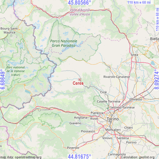
Ceres GPS coordinates[2]
45° 18' 48.096" North, 7° 23' 22.596" East
| Map corner | latitude | longitude |
|---|---|---|
| Upper-left | 45.80566°, | 6.68649° |
| Center: | 45.31336°, | 7.38961° |
| Lower-right: | 44.81675°, | 8.09274° |
| Map W x H: | 110×110 km | = 68.4×68.4mi |
| max Lat: | 47.04031° ⇑32.2% North |
| Ceres: | 45.31336° |
| min Lat: | ⇓67.8% South 35.50142° |
| min Long | Ceres | max Long |
| 6.69888° | 7.38961° | 18.48682° |
| W 1.6%⇐ | ⇒98.4% E |
Elevation
Elevation of Ceres is 701 m = 2300 ft, and this is 394.3 m = 1294 ft above average elevation for this country.
| Max E: |
2085 m = 6841 ft | 10.7% |
| Ceres | 701 m 2300 ft | |
| Avg. | 306.7 m = 1006 ft | |
Min E: |
-4 m = -13 ft | 89.3% |
See also: Italy elevation on elevation.city.
Geographical zone
Ceres is located in North temperate zone (between Tropic of Cancer and the Arctic Circle). Distance of this North polar circle is 2362.8 km =1468.2 mi to North.| Distance of | km | miles | from Ceres |
|---|---|---|---|
| North Pole | 4968.7 | 3087.4 | to North |
| Arctic Circle | 2362.8 | 1468.2 | to North |
| Tropic Cancer | 2432.5 | 1511.5 | to South |
| Equator | 5038.4 | 3130.7 | to South |


Nearby cities:
15 places around Ceres: (largest is in red/bold)
• Ala di Stura
6.7 km =4.2 mi,  271°
271°
• Balangero
11.2 km =7 mi,  115°
115°
• Cantoira
3 km =1.9 mi,  352°
352°
• Chialamberto
6.6 km =4.1 mi,  326°
326°
• Coassolo
5.9 km =3.7 mi,  106°
106°
• Coassolo Torinese
5.8 km =3.6 mi, 107°
• Corio
11.3 km =7 mi,  90°
90°
• Germagnano
8.3 km =5.2 mi,  131°
131°
• La Villa
6.1 km =3.8 mi,  147°
147°
• Lanzo Torinese
8.3 km =5.2 mi, 119°
• Mezzenile
2.1 km =1.3 mi,  167°
167°
• Monastero di Lanzo
4.1 km =2.5 mi, 108°
• Pessinetto
3.6 km =2.2 mi, 145°
• Traves
6 km =3.7 mi, 147°
• Viù
8.5 km =5.3 mi,  188°
188°
Sources, notices
• [Note1] Compared only with cities in Italy existing in our database
• [Src1] Map data: © OpenStreetMap contributors (CC-BY-SA)
• [Src2] Other city data from geonames.org with taken over terms of usage.
• [Src3] Geographical zone / Annual Mean Temperature by Robert A. Rohde @ Wikipedia
