Pescopagano geodata
Pescopagano (Basilicate) is a seat of a third-order administrative division; located in Italy in Europe/Rome (GMT+2) time zone. With population of 1,851 people, there are 4409 cities with bigger population in this country. Compared to other cities in Italy, 81% of cities are located further ↑North; 90.2% of cities are located further ←West and 96.2% of cities have lower elevation than Pescopagano. Note1


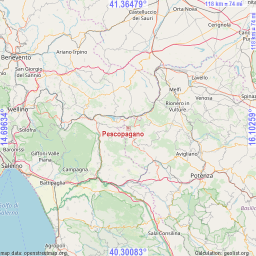
Pescopagano GPS coordinates[2]
40° 50' 5.784" North, 15° 23' 58.056" East
| Map corner | latitude | longitude |
|---|---|---|
| Upper-left | 41.36479°, | 14.69634° |
| Center: | 40.83494°, | 15.39946° |
| Lower-right: | 40.30083°, | 16.10259° |
| Map W x H: | 118.3×118.3 km | = 73.5×73.5mi |
| max Lat: | 47.04031° ⇑81% North |
| Pescopagano: | 40.83494° |
| min Lat: | ⇓19% South 35.50142° |
| min Long | Pescopagano | max Long |
| 6.69888° | 15.39946° | 18.48682° |
| W 90.2%⇐ | ⇒9.8% E |
Elevation
Elevation of Pescopagano is 947 m = 3107 ft, and this is 640.3 m = 2101 ft above average elevation for this country.
| Max E: |
2085 m = 6841 ft | 3.8% |
| Pescopagano | 947 m 3107 ft | |
| Avg. | 306.7 m = 1006 ft | |
Min E: |
-4 m = -13 ft | 96.2% |
See also: Italy elevation on elevation.city.
Geographical zone
Pescopagano is located in North temperate zone (between Tropic of Cancer and the Arctic Circle). Distance of this Northern Tropic circle is 1934.5 km =1202 mi to South.| Distance of | km | miles | from Pescopagano |
|---|---|---|---|
| North Pole | 5466.6 | 3396.8 | to North |
| Arctic Circle | 2860.8 | 1777.6 | to North |
| Tropic Cancer | 1934.5 | 1202 | to South |
| Equator | 4540.4 | 2821.3 | to South |


Nearby cities:
15 places around Pescopagano: (largest is in red/bold)
• Andretta-Mattinella
13 km =8.1 mi,  331°
331°
• Cairano
7.2 km =4.5 mi,  340°
340°
• Calitri
10.1 km =6.3 mi,  2°
2°
• Castelgrande
6 km =3.7 mi,  153°
153°
• Castelnuovo di Conza
7 km =4.3 mi,  256°
256°
• Centro Urbano
6.9 km =4.3 mi, 255°
• Laviano
9.4 km =5.8 mi,  234°
234°
• Muro Lucano
11.7 km =7.3 mi,  140°
140°
• Nuova Conza della Campania
5.9 km =3.7 mi,  296°
296°
• Rapone
8.4 km =5.2 mi,  80°
80°
• Ruvo del Monte
12.1 km =7.5 mi, 82°
• San Fele
12 km =7.5 mi,  99°
99°
• Sant'Andrea di Conza
2.7 km =1.7 mi,  293°
293°
• Santomenna
6.9 km =4.3 mi,  243°
243°
• Teora
12.4 km =7.7 mi,  279°
279°
Sources, notices
• [Note1] Compared only with cities in Italy existing in our database
• [Src1] Map data: © OpenStreetMap contributors (CC-BY-SA)
• [Src2] Other city data from geonames.org with taken over terms of usage.
• [Src3] Geographical zone / Annual Mean Temperature by Robert A. Rohde @ Wikipedia
