Cursolo geodata
Cursolo (Piedmont) is a seat of a third-order administrative division; located in Italy in Europe/Rome (GMT+1) time zone. With population of 46 people, there are 11610 cities with bigger population in this country. Compared to other cities in Italy, 94% of cities are located further ↓South; 87.1% of cities are located further →East and 95.1% of cities have lower elevation than Cursolo. Note1
Administrative division(s):
- Level 1: Piedmont
- Level 2: Provincia Verbano-Cusio-Ossola
- Level 3: Valle Cannobina


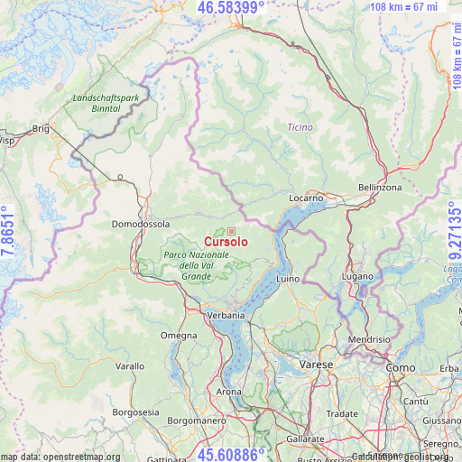
Cursolo GPS coordinates[2]
46° 5' 54.888" North, 8° 34' 5.592" East
| Map corner | latitude | longitude |
|---|---|---|
| Upper-left | 46.58399°, | 7.8651° |
| Center: | 46.09858°, | 8.56822° |
| Lower-right: | 45.60886°, | 9.27135° |
| Map W x H: | 108.4×108.4 km | = 67.4×67.4mi |
| max Lat: | 47.04031° ⇑6% North |
| Cursolo: | 46.09858° |
| min Lat: | ⇓94% South 35.50142° |
| min Long | Cursolo | max Long |
| 6.69888° | 8.56822° | 18.48682° |
| W 12.9%⇐ | ⇒87.1% E |
Elevation
Elevation of Cursolo is 876 m = 2874 ft, and this is 569.3 m = 1868 ft above average elevation for this country.
| Max E: |
2085 m = 6841 ft | 4.9% |
| Cursolo | 876 m 2874 ft | |
| Avg. | 306.7 m = 1006 ft | |
Min E: |
-4 m = -13 ft | 95.1% |
See also: Italy elevation on elevation.city.
Geographical zone
Cursolo is located in North temperate zone (between Tropic of Cancer and the Arctic Circle). Distance of this North polar circle is 2275.5 km =1413.9 mi to North.| Distance of | km | miles | from Cursolo |
|---|---|---|---|
| North Pole | 4881.4 | 3033.2 | to North |
| Arctic Circle | 2275.5 | 1413.9 | to North |
| Tropic Cancer | 2519.8 | 1565.7 | to South |
| Equator | 5125.7 | 3185 | to South |


Nearby cities:
15 places around Cursolo: (largest is in red/bold)
• Aurano
11 km =6.8 mi,  171°
171°
• Cannero Riviera
12.1 km =7.5 mi,  134°
134°
• Cannobio
10.7 km =6.6 mi,  112°
112°
• Cavaglio-Spoccia
5.7 km =3.5 mi,  122°
122°
• Craveggia
7.7 km =4.8 mi,  307°
307°
• Druogno
11.2 km =7 mi,  290°
290°
• Falmenta
3.3 km =2.1 mi,  149°
149°
• Gurro
1.5 km =0.9 mi,  181°
181°
• Intragna
11.6 km =7.2 mi, 177°
• Malesco
6.3 km =3.9 mi,  301°
301°
• Re
4 km =2.5 mi,  334°
334°
• Santa Maria Maggiore
9.3 km =5.8 mi, 297°
• Toceno
9.2 km =5.7 mi, 303°
• Trarego
10.6 km =6.6 mi, 132°
• Villette
4.5 km =2.8 mi,  324°
324°
Sources, notices
• [Note1] Compared only with cities in Italy existing in our database
• [Src1] Map data: © OpenStreetMap contributors (CC-BY-SA)
• [Src2] Other city data from geonames.org with taken over terms of usage.
• [Src3] Geographical zone / Annual Mean Temperature by Robert A. Rohde @ Wikipedia
