Aurano geodata
Aurano (Piedmont) is a seat of a third-order administrative division; located in Italy in Europe/Rome (GMT+2) time zone. With population of 89 people, there are 11479 cities with bigger population in this country. Compared to other cities in Italy, 92% of cities are located further ↓South; 86.8% of cities are located further →East and 90.2% of cities have lower elevation than Aurano. Note1
Administrative division(s):
- Level 1: Piedmont
- Level 2: Provincia Verbano-Cusio-Ossola
- Level 3: Aurano


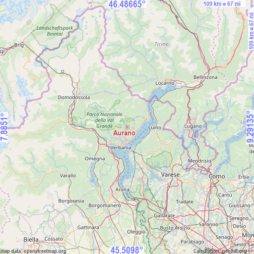
Aurano GPS coordinates[2]
46° 0' 1.368" North, 8° 35' 17.592" East
| Map corner | latitude | longitude |
|---|---|---|
| Upper-left | 46.48665°, | 7.8851° |
| Center: | 46.00038°, | 8.58822° |
| Lower-right: | 45.5098°, | 9.29135° |
| Map W x H: | 108.6×108.6 km | = 67.5×67.5mi |
| max Lat: | 47.04031° ⇑8% North |
| Aurano: | 46.00038° |
| min Lat: | ⇓92% South 35.50142° |
| min Long | Aurano | max Long |
| 6.69888° | 8.58822° | 18.48682° |
| W 13.2%⇐ | ⇒86.8% E |
Elevation
Elevation of Aurano is 726 m = 2382 ft, and this is 419.3 m = 1376 ft above average elevation for this country.
| Max E: |
2085 m = 6841 ft | 9.8% |
| Aurano | 726 m 2382 ft | |
| Avg. | 306.7 m = 1006 ft | |
Min E: |
-4 m = -13 ft | 90.2% |
See also: Italy elevation on elevation.city.
Geographical zone
Aurano is located in North temperate zone (between Tropic of Cancer and the Arctic Circle). Distance of this North polar circle is 2286.4 km =1420.7 mi to North.| Distance of | km | miles | from Aurano |
|---|---|---|---|
| North Pole | 4892.3 | 3039.9 | to North |
| Arctic Circle | 2286.4 | 1420.7 | to North |
| Tropic Cancer | 2508.8 | 1558.9 | to South |
| Equator | 5114.8 | 3178.2 | to South |


Nearby cities:
15 places around Aurano: (largest is in red/bold)
• Arizzano
4.8 km =3 mi,  184°
184°
• Bee
4.2 km =2.6 mi,  193°
193°
• Cambiasca
5.4 km =3.4 mi,  218°
218°
• Caprezzo
2.8 km =1.7 mi, 223°
• Cossogno
7.3 km =4.5 mi,  236°
236°
• Ghiffa
5.4 km =3.4 mi,  166°
166°
• Gonte
4.8 km =3 mi,  96°
96°
• Intragna
1.3 km =0.8 mi, 240°
• Miazzina
5.7 km =3.5 mi, 241°
• Oggebbio
4.6 km =2.9 mi, 103°
• Pallanza-Intra-Suna
7.1 km =4.4 mi, 190°
• Premeno
2.5 km =1.6 mi, 166°
• San Bernardino Verbano
7.2 km =4.5 mi,  227°
227°
• Santino
7.3 km =4.5 mi, 227°
• Vignone
4.8 km =3 mi,  203°
203°
Sources, notices
• [Note1] Compared only with cities in Italy existing in our database
• [Src1] Map data: © OpenStreetMap contributors (CC-BY-SA)
• [Src2] Other city data from geonames.org with taken over terms of usage.
• [Src3] Geographical zone / Annual Mean Temperature by Robert A. Rohde @ Wikipedia
