Nespolo geodata
Nespolo (Latium) is a seat of a third-order administrative division; located in Italy in Europe/Rome (GMT+2) time zone. With population of 274 people, there are 10784 cities with bigger population in this country. Compared to other cities in Italy, 69% of cities are located further ↑North; 69.1% of cities are located further ←West and 94.9% of cities have lower elevation than Nespolo. Note1


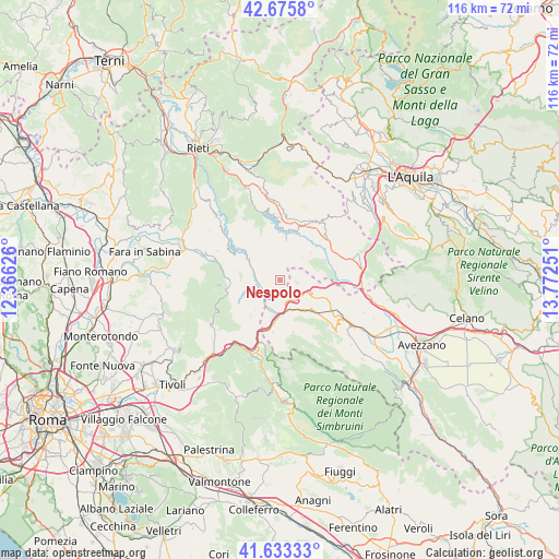
Nespolo GPS coordinates[2]
42° 9' 24.156" North, 13° 4' 9.768" East
| Map corner | latitude | longitude |
|---|---|---|
| Upper-left | 42.6758°, | 12.36626° |
| Center: | 42.15671°, | 13.06938° |
| Lower-right: | 41.63333°, | 13.77251° |
| Map W x H: | 115.9×115.9 km | = 72×72mi |
| max Lat: | 47.04031° ⇑69% North |
| Nespolo: | 42.15671° |
| min Lat: | ⇓31% South 35.50142° |
| min Long | Nespolo | max Long |
| 6.69888° | 13.06938° | 18.48682° |
| W 69.1%⇐ | ⇒30.9% E |
Elevation
Elevation of Nespolo is 870 m = 2854 ft, and this is 563.3 m = 1848 ft above average elevation for this country.
| Max E: |
2085 m = 6841 ft | 5.1% |
| Nespolo | 870 m 2854 ft | |
| Avg. | 306.7 m = 1006 ft | |
Min E: |
-4 m = -13 ft | 94.9% |
See also: Italy elevation on elevation.city.
Geographical zone
Nespolo is located in North temperate zone (between Tropic of Cancer and the Arctic Circle). Distance of this Northern Tropic circle is 2081.5 km =1293.4 mi to South.| Distance of | km | miles | from Nespolo |
|---|---|---|---|
| North Pole | 5319.7 | 3305.5 | to North |
| Arctic Circle | 2713.8 | 1686.3 | to North |
| Tropic Cancer | 2081.5 | 1293.4 | to South |
| Equator | 4687.4 | 2912.6 | to South |


Nearby cities:
15 places around Nespolo: (largest is in red/bold)
• Ascrea
7.7 km =4.8 mi,  306°
306°
• Carsoli
6.6 km =4.1 mi,  166°
166°
• Castel di Tora
10.3 km =6.4 mi, 308°
• Collalto Sabino
2.9 km =1.8 mi,  215°
215°
• Collegiove
3.3 km =2.1 mi, 308°
• Marcetelli
8 km =5 mi,  346°
346°
• Orvinio
11.3 km =7 mi,  254°
254°
• Paganico Sabino
7 km =4.3 mi,  301°
301°
• Pereto
11.3 km =7 mi, 166°
• Pescorocchiano
8.4 km =5.2 mi,  49°
49°
• Pozzaglia Sabino
8.7 km =5.4 mi,  271°
271°
• Turania
5.5 km =3.4 mi,  243°
243°
• Vallinfreda
10 km =6.2 mi, 217°
• Varco Sabino
10.1 km =6.3 mi,  336°
336°
• Vivaro Romano
8.1 km =5 mi, 220°
Sources, notices
• [Note1] Compared only with cities in Italy existing in our database
• [Src1] Map data: © OpenStreetMap contributors (CC-BY-SA)
• [Src2] Other city data from geonames.org with taken over terms of usage.
• [Src3] Geographical zone / Annual Mean Temperature by Robert A. Rohde @ Wikipedia
