Montelupone geodata
Montelupone (The Marches) is a seat of a third-order administrative division; located in Italy in Europe/Rome (GMT+2) time zone. With population of 1,827 people, there are 4451 cities with bigger population in this country. Compared to other cities in Italy, 60.9% of cities are located further ↑North; 74.3% of cities are located further ←West and 53% of cities have lower elevation than Montelupone. Note1
Administrative division(s):
- Level 1: The Marches
- Level 2: Provincia di Macerata
- Level 3: Montelupone


Montelupone GPS coordinates[2]
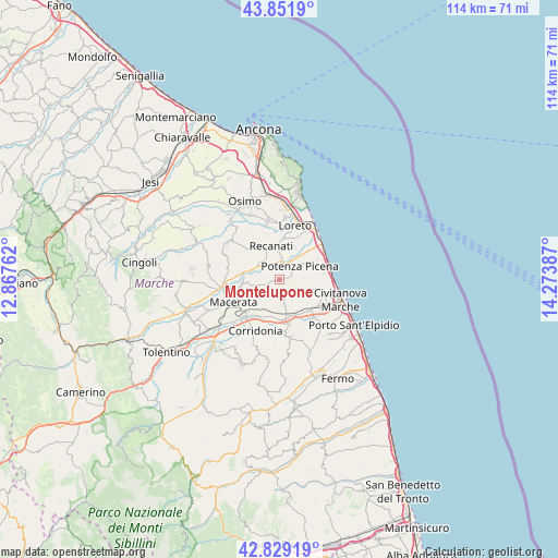
43° 20' 33.72" North, 13° 34' 14.664" East
| Map corner | latitude | longitude |
|---|---|---|
| Upper-left | 43.8519°, | 12.86762° |
| Center: | 43.3427°, | 13.57074° |
| Lower-right: | 42.82919°, | 14.27387° |
| Map W x H: | 113.7×113.7 km | = 70.6×70.6mi |
| max Lat: | 47.04031° ⇑60.9% North |
| Montelupone: | 43.3427° |
| min Lat: | ⇓39.1% South 35.50142° |
| min Long | Montelupone | max Long |
| 6.69888° | 13.57074° | 18.48682° |
| W 74.3%⇐ | ⇒25.7% E |
Elevation
Elevation of Montelupone is 253 m = 830 ft, and this is 53.7 m = 176 ft below average elevation for this country.
| Max E: |
2085 m = 6841 ft | 47% |
| Avg. | 306.7 m = 1006 ft | |
| Montelupone | 253 m = 830 ft | |
Min E: |
-4 m = -13 ft | 53% |
See also: Italy elevation on elevation.city.
Geographical zone
Montelupone is located in North temperate zone (between Tropic of Cancer and the Arctic Circle). Distance of this Northern Tropic circle is 2213.3 km =1375.3 mi to South.| Distance of | km | miles | from Montelupone |
|---|---|---|---|
| North Pole | 5187.8 | 3223.5 | to North |
| Arctic Circle | 2581.9 | 1604.3 | to North |
| Tropic Cancer | 2213.3 | 1375.3 | to South |
| Equator | 4819.3 | 2994.6 | to South |


Nearby cities:
15 places around Montelupone: (largest is in red/bold)
• Borgo Stazione
8.8 km =5.5 mi,  137°
137°
• Civitanova Alta
9.3 km =5.8 mi,  108°
108°
• Montecosaro
6.2 km =3.9 mi,  118°
118°
• Morrovalle
3.4 km =2.1 mi, 143°
• Piediripa
9.9 km =6.2 mi,  223°
223°
• Pintura
4.2 km =2.6 mi,  168°
168°
• Porto Potenza Picena
10.4 km =6.5 mi,  80°
80°
• Potenza Picena
4.9 km =3 mi,  57°
57°
• Recanati
6.9 km =4.3 mi,  348°
348°
• San Claudio
9.3 km =5.8 mi, 216°
• Sant'Egidio
9.2 km =5.7 mi,  272°
272°
• Stazione Morrovalle
7 km =4.3 mi, 169°
• Trodica
7.8 km =4.8 mi, 166°
• Vagli
10.5 km =6.5 mi,  150°
150°
• Villa San Filippo
9.4 km =5.8 mi, 168°
Sources, notices
• [Note1] Compared only with cities in Italy existing in our database
• [Src1] Map data: © OpenStreetMap contributors (CC-BY-SA)
• [Src2] Other city data from geonames.org with taken over terms of usage.
• [Src3] Geographical zone / Annual Mean Temperature by Robert A. Rohde @ Wikipedia
