Michellorie geodata
Michellorie (Veneto) is a populated place; located in Italy in Europe/Rome (GMT+2) time zone. With population of 555 people, there are 9400 cities with bigger population in this country. Compared to other cities in Italy, 67.1% of cities are located further ↓South; 53% of cities are located further →East and 88.7% of cities have higher elevation than Michellorie. Note1


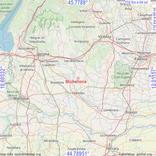
Michellorie GPS coordinates[2]
45° 17' 10.896" North, 11° 18' 30.384" East
| Map corner | latitude | longitude |
|---|---|---|
| Upper-left | 45.7789°, | 10.60532° |
| Center: | 45.28636°, | 11.30844° |
| Lower-right: | 44.78951°, | 12.01157° |
| Map W x H: | 110×110 km | = 68.4×68.4mi |
| max Lat: | 47.04031° ⇑32.9% North |
| Michellorie: | 45.28636° |
| min Lat: | ⇓67.1% South 35.50142° |
| min Long | Michellorie | max Long |
| 6.69888° | 11.30844° | 18.48682° |
| W 47%⇐ | ⇒53% E |
Elevation
Elevation of Michellorie is 21 m = 69 ft, and this is 285.7 m = 937 ft below average elevation for this country.
| Max E: |
2085 m = 6841 ft | 88.7% |
| Avg. | 306.7 m = 1006 ft | |
| Michellorie | 21 m = 69 ft | |
Min E: |
-4 m = -13 ft | 11.3% |
See also: Italy elevation on elevation.city.
Geographical zone
Michellorie is located in North temperate zone (between Tropic of Cancer and the Arctic Circle). Distance of this North polar circle is 2365.8 km =1470 mi to North.| Distance of | km | miles | from Michellorie |
|---|---|---|---|
| North Pole | 4971.7 | 3089.3 | to North |
| Arctic Circle | 2365.8 | 1470 | to North |
| Tropic Cancer | 2429.5 | 1509.6 | to South |
| Equator | 5035.4 | 3128.9 | to South |


Nearby cities:
15 places around Michellorie: (largest is in red/bold)
• Albaredo d'Adige
4.3 km =2.7 mi,  326°
326°
• Angiari
7.4 km =4.6 mi,  199°
199°
• Bonavigo
3.9 km =2.4 mi,  216°
216°
• Caselle
4.4 km =2.7 mi,  106°
106°
• Cologna Veneta
6.1 km =3.8 mi,  67°
67°
• Coriano
2 km =1.2 mi,  232°
232°
• Gallese
7.1 km =4.4 mi,  165°
165°
• Minerbe
7 km =4.3 mi,  150°
150°
• Pressana
7.7 km =4.8 mi,  93°
93°
• Roverchiara
5.4 km =3.4 mi,  247°
247°
• Roverchiaretta
4.9 km =3 mi, 230°
• San Gregorio
6.3 km =3.9 mi,  353°
353°
• Tombazosana
5.1 km =3.2 mi,  307°
307°
• Veronella
4.4 km =2.7 mi,  18°
18°
• Zimella
7.3 km =4.5 mi,  46°
46°
Sources, notices
• [Note1] Compared only with cities in Italy existing in our database
• [Src1] Map data: © OpenStreetMap contributors (CC-BY-SA)
• [Src2] Other city data from geonames.org with taken over terms of usage.
• [Src3] Geographical zone / Annual Mean Temperature by Robert A. Rohde @ Wikipedia
