Margarita geodata
Margarita (Piedmont) is a seat of a third-order administrative division; located in Italy in Europe/Rome (GMT+2) time zone. With population of 1,042 people, there are 6497 cities with bigger population in this country. Compared to other cities in Italy, 50.4% of cities are located further ↑North; 96.4% of cities are located further →East and 74.8% of cities have lower elevation than Margarita. Note1


Margarita GPS coordinates[2]
44° 24' 12.348" North, 7° 41' 5.748" East
| Map corner | latitude | longitude |
|---|---|---|
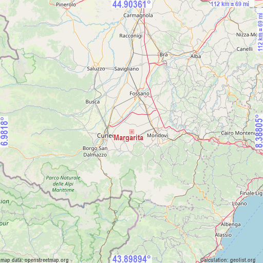
| Upper-left | 44.90361°, | 6.9818° |
| Center: | 44.40343°, | 7.68493° |
| Lower-right: | 43.89894°, | 8.38805° |
| Map W x H: | 111.7×111.7 km | = 69.4×69.4mi |
| max Lat: | 47.04031° ⇑50.4% North |
| Margarita: | 44.40343° |
| min Lat: | ⇓49.6% South 35.50142° |
| min Long | Margarita | max Long |
| 6.69888° | 7.68493° | 18.48682° |
| W 3.6%⇐ | ⇒96.4% E |
Elevation
Elevation of Margarita is 449 m = 1473 ft, and this is 142.3 m = 467 ft above average elevation for this country.
| Max E: |
2085 m = 6841 ft | 25.2% |
| Margarita | 449 m 1473 ft | |
| Avg. | 306.7 m = 1006 ft | |
Min E: |
-4 m = -13 ft | 74.8% |
See also: Italy elevation on elevation.city.
Geographical zone
Margarita is located in North temperate zone (between Tropic of Cancer and the Arctic Circle). Distance of this Northern Tropic circle is 2331.3 km =1448.6 mi to South.| Distance of | km | miles | from Margarita |
|---|---|---|---|
| North Pole | 5069.9 | 3150.3 | to North |
| Arctic Circle | 2464 | 1531.1 | to North |
| Tropic Cancer | 2331.3 | 1448.6 | to South |
| Equator | 4937.2 | 3067.8 | to South |


Nearby cities:
15 places around Margarita: (largest is in red/bold)
• Beinette
5.4 km =3.4 mi,  216°
216°
• Castelletto Stura
5.8 km =3.6 mi,  321°
321°
• Chiusa di Pesio
8.7 km =5.4 mi,  185°
185°
• Crava
5.6 km =3.5 mi,  58°
58°
• Mondovì
10.6 km =6.6 mi,  94°
94°
• Montanera
6.7 km =4.2 mi,  346°
346°
• Morozzo
2.9 km =1.8 mi,  42°
42°
• Peveragno
10.6 km =6.6 mi,  209°
209°
• Pianfei
4.1 km =2.5 mi,  148°
148°
• Roata Chiusani
9.8 km =6.1 mi,  311°
311°
• Rocca De' Baldi
6.5 km =4 mi,  69°
69°
• San Biagio
10.5 km =6.5 mi,  325°
325°
• San Lorenzo
9.5 km =5.9 mi,  230°
230°
• Sant'Anna Avagnina
8.6 km =5.3 mi, 88°
• Villanova Mondovì
9 km =5.6 mi,  133°
133°
Sources, notices
• [Note1] Compared only with cities in Italy existing in our database
• [Src1] Map data: © OpenStreetMap contributors (CC-BY-SA)
• [Src2] Other city data from geonames.org with taken over terms of usage.
• [Src3] Geographical zone / Annual Mean Temperature by Robert A. Rohde @ Wikipedia
