Castelletto Stura geodata
Castelletto Stura (Piedmont) is a seat of a third-order administrative division; located in Italy in Europe/Rome (GMT+2) time zone. With population of 907 people, there are 7111 cities with bigger population in this country. Compared to other cities in Italy, 50.2% of cities are located further ↓South; 96.8% of cities are located further →East and 74.5% of cities have lower elevation than Castelletto Stura. Note1
Administrative division(s):
- Level 1: Piedmont
- Level 2: Provincia di Cuneo
- Level 3: Castelletto Stura


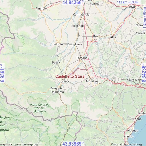
Castelletto Stura GPS coordinates[2]
44° 26' 37.788" North, 7° 38' 21.228" East
| Map corner | latitude | longitude |
|---|---|---|
| Upper-left | 44.94366°, | 6.93611° |
| Center: | 44.44383°, | 7.63923° |
| Lower-right: | 43.93969°, | 8.34236° |
| Map W x H: | 111.6×111.6 km | = 69.3×69.3mi |
| max Lat: | 47.04031° ⇑49.8% North |
| Castelletto Stura: | 44.44383° |
| min Lat: | ⇓50.2% South 35.50142° |
| min Long | Castelletto Stu | max Long |
| 6.69888° | 7.63923° | 18.48682° |
| W 3.2%⇐ | ⇒96.8% E |
Elevation
Elevation of Castelletto Stura is 445 m = 1460 ft, and this is 138.3 m = 454 ft above average elevation for this country.
| Max E: |
2085 m = 6841 ft | 25.5% |
| Castelletto Stura | 445 m 1460 ft | |
| Avg. | 306.7 m = 1006 ft | |
Min E: |
-4 m = -13 ft | 74.5% |
See also: Italy elevation on elevation.city.
Geographical zone
Castelletto Stura is located in North temperate zone (between Tropic of Cancer and the Arctic Circle). Distance of this Northern Tropic circle is 2335.8 km =1451.4 mi to South.| Distance of | km | miles | from Castelletto Stura |
|---|---|---|---|
| North Pole | 5065.4 | 3147.5 | to North |
| Arctic Circle | 2459.5 | 1528.3 | to North |
| Tropic Cancer | 2335.8 | 1451.4 | to South |
| Equator | 4941.7 | 3070.6 | to South |


Nearby cities:
15 places around Castelletto Stura: (largest is in red/bold)
• Beinette
8.9 km =5.5 mi,  177°
177°
• Centallo
7.6 km =4.7 mi,  327°
327°
• Crava
8.5 km =5.3 mi,  100°
100°
• Cuneo
9.3 km =5.8 mi,  230°
230°
• Margarita
5.8 km =3.6 mi,  141°
141°
• Montanera
2.9 km =1.8 mi,  45°
45°
• Morozzo
6.1 km =3.8 mi,  112°
112°
• Passatore
10.6 km =6.6 mi,  262°
262°
• Pianfei
9.8 km =6.1 mi, 144°
• Roata Chiusani
4.2 km =2.6 mi,  298°
298°
• Roata Rossi
9 km =5.6 mi,  270°
270°
• Rocca De' Baldi
9.9 km =6.2 mi, 103°
• San Biagio
4.8 km =3 mi, 331°
• Sant'Albano Stura
9.7 km =6 mi,  43°
43°
• Tarantasca
9.3 km =5.8 mi,  306°
306°
Sources, notices
• [Note1] Compared only with cities in Italy existing in our database
• [Src1] Map data: © OpenStreetMap contributors (CC-BY-SA)
• [Src2] Other city data from geonames.org with taken over terms of usage.
• [Src3] Geographical zone / Annual Mean Temperature by Robert A. Rohde @ Wikipedia
