Lungavilla geodata
Lungavilla (Lombardy) is a seat of a third-order administrative division; located in Italy in Europe/Rome (GMT+2) time zone. With population of 2,371 people, there are 3672 cities with bigger population in this country. Compared to other cities in Italy, 61% of cities are located further ↓South; 80% of cities are located further →East and 75.6% of cities have higher elevation than Lungavilla. Note1


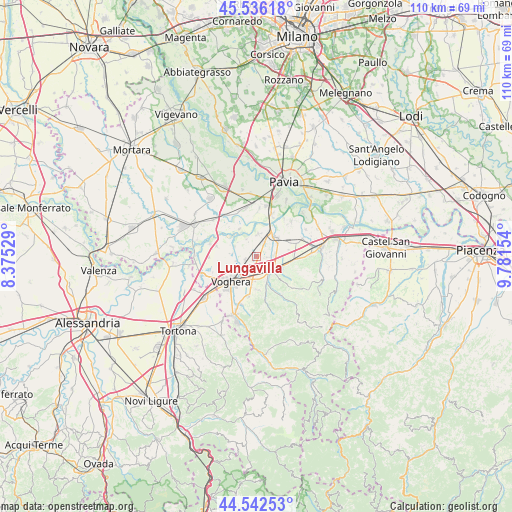
Lungavilla GPS coordinates[2]
45° 2' 29.436" North, 9° 4' 42.312" East
| Map corner | latitude | longitude |
|---|---|---|
| Upper-left | 45.53618°, | 8.37529° |
| Center: | 45.04151°, | 9.07842° |
| Lower-right: | 44.54253°, | 9.78154° |
| Map W x H: | 110.5×110.5 km | = 68.7×68.7mi |
| max Lat: | 47.04031° ⇑39% North |
| Lungavilla: | 45.04151° |
| min Lat: | ⇓61% South 35.50142° |
| min Long | Lungavilla | max Long |
| 6.69888° | 9.07842° | 18.48682° |
| W 20%⇐ | ⇒80% E |
Elevation
Elevation of Lungavilla is 71 m = 233 ft, and this is 235.7 m = 773 ft below average elevation for this country.
| Max E: |
2085 m = 6841 ft | 75.6% |
| Avg. | 306.7 m = 1006 ft | |
| Lungavilla | 71 m = 233 ft | |
Min E: |
-4 m = -13 ft | 24.4% |
See also: Italy elevation on elevation.city.
Geographical zone
Lungavilla is located in North temperate zone (between Tropic of Cancer and the Arctic Circle). Distance of this North polar circle is 2393 km =1486.9 mi to North.| Distance of | km | miles | from Lungavilla |
|---|---|---|---|
| North Pole | 4998.9 | 3106.2 | to North |
| Arctic Circle | 2393 | 1486.9 | to North |
| Tropic Cancer | 2402.2 | 1492.7 | to South |
| Equator | 5008.1 | 3111.9 | to South |


Nearby cities:
15 places around Lungavilla: (largest is in red/bold)
• Bastida Pancarana
5 km =3.1 mi,  6°
6°
• Bressana
5.8 km =3.6 mi,  45°
45°
• Casatisma
4.2 km =2.6 mi,  83°
83°
• Casteggio
4.8 km =3 mi,  129°
129°
• Castelletto Po
3.5 km =2.2 mi,  29°
29°
• Castelletto di Branduzzo
3.5 km =2.2 mi, 26°
• Cervesina
5.3 km =3.3 mi,  293°
293°
• Fumo
6.2 km =3.9 mi,  109°
109°
• Mezzana Rabattone
6.9 km =4.3 mi,  328°
328°
• Montebello
5 km =3.1 mi,  157°
157°
• Pancarana
4.3 km =2.7 mi, 330°
• Pizzale
2.3 km =1.4 mi,  261°
261°
• Robecco Pavese
5.7 km =3.5 mi, 82°
• Torrazza Coste
7 km =4.3 mi,  181°
181°
• Verretto
2.7 km =1.7 mi,  94°
94°
Sources, notices
• [Note1] Compared only with cities in Italy existing in our database
• [Src1] Map data: © OpenStreetMap contributors (CC-BY-SA)
• [Src2] Other city data from geonames.org with taken over terms of usage.
• [Src3] Geographical zone / Annual Mean Temperature by Robert A. Rohde @ Wikipedia
