Ligosullo geodata
Ligosullo (Friuli Venezia Giulia) is a seat of a third-order administrative division; located in Italy in Europe/Rome (GMT+2) time zone. With population of 140 people, there are 11313 cities with bigger population in this country. Compared to other cities in Italy, 98.6% of cities are located further ↓South; 69.1% of cities are located further ←West and 96.5% of cities have lower elevation than Ligosullo. Note1
Administrative division(s):
- Level 1: Friuli Venezia Giulia
- Level 2: Provincia di Udine
- Level 3: Treppo Ligosullo


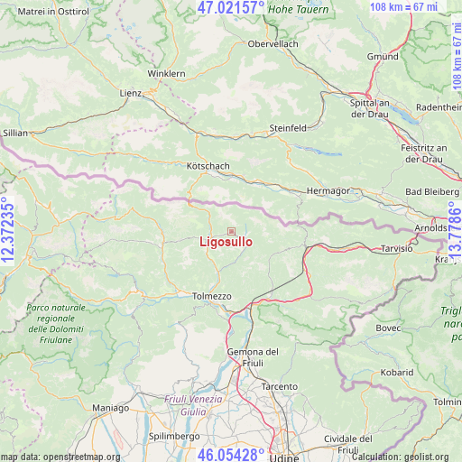
Ligosullo GPS coordinates[2]
46° 32' 24.288" North, 13° 4' 31.692" East
| Map corner | latitude | longitude |
|---|---|---|
| Upper-left | 47.02157°, | 12.37235° |
| Center: | 46.54008°, | 13.07547° |
| Lower-right: | 46.05428°, | 13.7786° |
| Map W x H: | 107.6×107.6 km | = 66.9×66.9mi |
| max Lat: | 47.04031° ⇑1.4% North |
| Ligosullo: | 46.54008° |
| min Lat: | ⇓98.6% South 35.50142° |
| min Long | Ligosullo | max Long |
| 6.69888° | 13.07547° | 18.48682° |
| W 69.1%⇐ | ⇒30.9% E |
Elevation
Elevation of Ligosullo is 959 m = 3146 ft, and this is 652.3 m = 2140 ft above average elevation for this country.
| Max E: |
2085 m = 6841 ft | 3.5% |
| Ligosullo | 959 m 3146 ft | |
| Avg. | 306.7 m = 1006 ft | |
Min E: |
-4 m = -13 ft | 96.5% |
See also: Italy elevation on elevation.city.
Geographical zone
Ligosullo is located in North temperate zone (between Tropic of Cancer and the Arctic Circle). Distance of this North polar circle is 2226.4 km =1383.4 mi to North.| Distance of | km | miles | from Ligosullo |
|---|---|---|---|
| North Pole | 4832.3 | 3002.7 | to North |
| Arctic Circle | 2226.4 | 1383.4 | to North |
| Tropic Cancer | 2568.9 | 1596.2 | to South |
| Equator | 5174.8 | 3215.5 | to South |


Nearby cities:
15 places around Ligosullo: (largest is in red/bold)
• Arta Terme
7.9 km =4.9 mi,  212°
212°
• Caneva di Tolmezzo
15.7 km =9.8 mi,  203°
203°
• Cercivento
6.5 km =4 mi,  257°
257°
• Comeglians
16.2 km =10.1 mi, 260°
• Lauco
16.9 km =10.5 mi,  220°
220°
• Moggio Udinese
17.3 km =10.7 mi,  146°
146°
• Moggio di Sotto
17.4 km =10.8 mi, 148°
• Ovaro
17.1 km =10.6 mi,  248°
248°
• Paluzza
4.6 km =2.9 mi, 258°
• Paularo
3.5 km =2.2 mi,  106°
106°
• Ravascletto
11.9 km =7.4 mi, 261°
• Sutrio
7 km =4.3 mi,  243°
243°
• Tolmezzo
16.1 km =10 mi, 195°
• Treppo Carnico
2.6 km =1.6 mi, 252°
• Zuglio
9.9 km =6.2 mi, 202°
Sources, notices
• [Note1] Compared only with cities in Italy existing in our database
• [Src1] Map data: © OpenStreetMap contributors (CC-BY-SA)
• [Src2] Other city data from geonames.org with taken over terms of usage.
• [Src3] Geographical zone / Annual Mean Temperature by Robert A. Rohde @ Wikipedia
