Treppo Carnico geodata
Treppo Carnico (Friuli Venezia Giulia) is a seat of a third-order administrative division; located in Italy in Europe/Rome (GMT+2) time zone. With population of 555 people, there are 9400 cities with bigger population in this country. Compared to other cities in Italy, 98.5% of cities are located further ↓South; 68.8% of cities are located further ←West and 88% of cities have lower elevation than Treppo Carnico. Note1
Administrative division(s):
- Level 1: Friuli Venezia Giulia
- Level 2: Provincia di Udine
- Level 3: Treppo Ligosullo


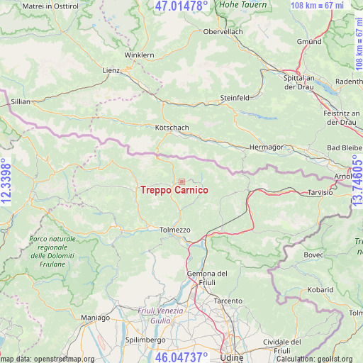
Treppo Carnico GPS coordinates[2]
46° 31' 59.628" North, 13° 2' 34.512" East
| Map corner | latitude | longitude |
|---|---|---|
| Upper-left | 47.01478°, | 12.3398° |
| Center: | 46.53323°, | 13.04292° |
| Lower-right: | 46.04737°, | 13.74605° |
| Map W x H: | 107.6×107.6 km | = 66.9×66.9mi |
| max Lat: | 47.04031° ⇑1.5% North |
| Treppo Carnico: | 46.53323° |
| min Lat: | ⇓98.5% South 35.50142° |
| min Long | Treppo Carnico | max Long |
| 6.69888° | 13.04292° | 18.48682° |
| W 68.8%⇐ | ⇒31.2% E |
Elevation
Elevation of Treppo Carnico is 672 m = 2205 ft, and this is 365.3 m = 1198 ft above average elevation for this country.
| Max E: |
2085 m = 6841 ft | 12% |
| Treppo Carnico | 672 m 2205 ft | |
| Avg. | 306.7 m = 1006 ft | |
Min E: |
-4 m = -13 ft | 88% |
See also: Italy elevation on elevation.city.
Geographical zone
Treppo Carnico is located in North temperate zone (between Tropic of Cancer and the Arctic Circle). Distance of this North polar circle is 2227.2 km =1383.9 mi to North.| Distance of | km | miles | from Treppo Carnico |
|---|---|---|---|
| North Pole | 4833.1 | 3003.1 | to North |
| Arctic Circle | 2227.2 | 1383.9 | to North |
| Tropic Cancer | 2568.1 | 1595.7 | to South |
| Equator | 5174 | 3215 | to South |


Nearby cities:
15 places around Treppo Carnico: (largest is in red/bold)
• Arta Terme
6.1 km =3.8 mi,  196°
196°
• Caneva di Tolmezzo
14.2 km =8.8 mi, 195°
• Cercivento
3.9 km =2.4 mi,  260°
260°
• Comeglians
13.7 km =8.5 mi, 261°
• Lauco
14.8 km =9.2 mi,  214°
214°
• Ligosullo
2.6 km =1.6 mi,  72°
72°
• Ovaro
14.5 km =9 mi,  247°
247°
• Paluzza
2.1 km =1.3 mi,  266°
266°
• Paularo
5.8 km =3.6 mi,  92°
92°
• Ravascletto
9.3 km =5.8 mi, 264°
• Rigolato
15.2 km =9.4 mi,  278°
278°
• Sutrio
4.5 km =2.8 mi,  238°
238°
• Tolmezzo
14.9 km =9.3 mi,  186°
186°
• Villa Santina
16.1 km =10 mi, 214°
• Zuglio
8.4 km =5.2 mi, 188°
Sources, notices
• [Note1] Compared only with cities in Italy existing in our database
• [Src1] Map data: © OpenStreetMap contributors (CC-BY-SA)
• [Src2] Other city data from geonames.org with taken over terms of usage.
• [Src3] Geographical zone / Annual Mean Temperature by Robert A. Rohde @ Wikipedia
