Lenno geodata
Lenno (Lombardy) is a seat of a third-order administrative division; located in Italy in Europe/Rome (GMT+2) time zone. With population of 1,833 people, there are 4437 cities with bigger population in this country. Compared to other cities in Italy, 91.2% of cities are located further ↓South; 78.1% of cities are located further →East and 50.4% of cities have lower elevation than Lenno. Note1


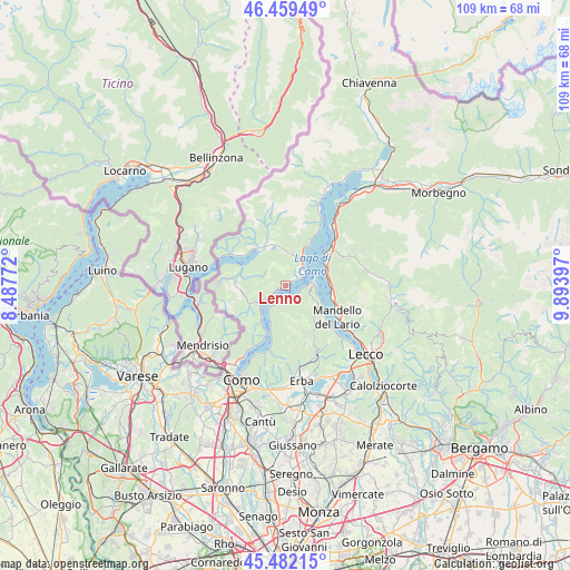
Lenno GPS coordinates[2]
45° 58' 22.728" North, 9° 11' 27.024" East
| Map corner | latitude | longitude |
|---|---|---|
| Upper-left | 46.45949°, | 8.48772° |
| Center: | 45.97298°, | 9.19084° |
| Lower-right: | 45.48215°, | 9.89397° |
| Map W x H: | 108.7×108.7 km | = 67.5×67.5mi |
| max Lat: | 47.04031° ⇑8.8% North |
| Lenno: | 45.97298° |
| min Lat: | ⇓91.2% South 35.50142° |
| min Long | Lenno | max Long |
| 6.69888° | 9.19084° | 18.48682° |
| W 21.9%⇐ | ⇒78.1% E |
Elevation
Elevation of Lenno is 237 m = 778 ft, and this is 69.7 m = 229 ft below average elevation for this country.
| Max E: |
2085 m = 6841 ft | 49.6% |
| Avg. | 306.7 m = 1006 ft | |
| Lenno | 237 m = 778 ft | |
Min E: |
-4 m = -13 ft | 50.4% |
See also: Italy elevation on elevation.city.
Geographical zone
Lenno is located in North temperate zone (between Tropic of Cancer and the Arctic Circle). Distance of this North polar circle is 2289.5 km =1422.6 mi to North.| Distance of | km | miles | from Lenno |
|---|---|---|---|
| North Pole | 4895.3 | 3041.8 | to North |
| Arctic Circle | 2289.5 | 1422.6 | to North |
| Tropic Cancer | 2505.8 | 1557 | to South |
| Equator | 5111.7 | 3176.3 | to South |


Nearby cities:
15 places around Lenno: (largest is in red/bold)
• Argegno
6 km =3.7 mi,  235°
235°
• Azzano
1.3 km =0.8 mi,  46°
46°
• Bellagio
5.7 km =3.5 mi,  73°
73°
• Bene Lario
6.2 km =3.9 mi,  355°
355°
• Cadenabbia
3.9 km =2.4 mi,  63°
63°
• Codogna-Cardano
6.3 km =3.9 mi,  13°
13°
• Colonno
3.4 km =2.1 mi, 239°
• Grandola ed Uniti
6 km =3.7 mi,  16°
16°
• Griante
4.3 km =2.7 mi, 54°
• Lezzeno
3.2 km =2 mi,  188°
188°
• Mezzegra
1.5 km =0.9 mi, 48°
• Ossuccio
0.9 km =0.6 mi,  246°
246°
• Pigra
5.3 km =3.3 mi, 250°
• Sala Comacina
2.2 km =1.4 mi, 242°
• Tremezzo
2.3 km =1.4 mi, 57°
Sources, notices
• [Note1] Compared only with cities in Italy existing in our database
• [Src1] Map data: © OpenStreetMap contributors (CC-BY-SA)
• [Src2] Other city data from geonames.org with taken over terms of usage.
• [Src3] Geographical zone / Annual Mean Temperature by Robert A. Rohde @ Wikipedia
