Lauregno geodata
Lauregno (Trentino-Alto Adige) is a seat of a third-order administrative division; located in Italy in Europe/Rome (GMT+2) time zone. With population of 77 people, there are 11518 cities with bigger population in this country. Compared to other cities in Italy, 98.1% of cities are located further ↓South; 56.5% of cities are located further →East and 98.3% of cities have lower elevation than Lauregno. Note1


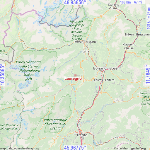
Lauregno GPS coordinates[2]
46° 27' 15.516" North, 11° 3' 42.372" East
| Map corner | latitude | longitude |
|---|---|---|
| Upper-left | 46.93656°, | 10.35865° |
| Center: | 46.45431°, | 11.06177° |
| Lower-right: | 45.96775°, | 11.7649° |
| Map W x H: | 107.7×107.7 km | = 66.9×66.9mi |
| max Lat: | 47.04031° ⇑1.9% North |
| Lauregno: | 46.45431° |
| min Lat: | ⇓98.1% South 35.50142° |
| min Long | Lauregno | max Long |
| 6.69888° | 11.06177° | 18.48682° |
| W 43.5%⇐ | ⇒56.5% E |
Elevation
Elevation of Lauregno is 1152 m = 3780 ft, and this is 845.3 m = 2773 ft above average elevation for this country.
| Max E: |
2085 m = 6841 ft | 1.7% |
| Lauregno | 1152 m 3780 ft | |
| Avg. | 306.7 m = 1006 ft | |
Min E: |
-4 m = -13 ft | 98.3% |
See also: Italy elevation on elevation.city.
Geographical zone
Lauregno is located in North temperate zone (between Tropic of Cancer and the Arctic Circle). Distance of this North polar circle is 2235.9 km =1389.3 mi to North.| Distance of | km | miles | from Lauregno |
|---|---|---|---|
| North Pole | 4841.8 | 3008.6 | to North |
| Arctic Circle | 2235.9 | 1389.3 | to North |
| Tropic Cancer | 2559.3 | 1590.3 | to South |
| Equator | 5165.2 | 3209.5 | to South |


Nearby cities:
15 places around Lauregno: (largest is in red/bold)
• Brez
4.2 km =2.6 mi,  126°
126°
• Cagnò
6.9 km =4.3 mi,  193°
193°
• Castelfondo
4.3 km =2.7 mi,  87°
87°
• Cloz
4.6 km =2.9 mi,  156°
156°
• Dambel
6 km =3.7 mi, 156°
• Fondo
6 km =3.7 mi,  106°
106°
• Livo
6.4 km =4 mi,  210°
210°
• Malosco
6.8 km =4.2 mi, 107°
• Proves - Proveis
3.9 km =2.4 mi,  309°
309°
• Revò
6.9 km =4.3 mi,  182°
182°
• Romallo
6.4 km =4 mi, 176°
• Rumo
3.6 km =2.2 mi,  246°
246°
• San Felice
6.9 km =4.3 mi,  49°
49°
• Sarnonico
7.3 km =4.5 mi,  122°
122°
• Senale
7.3 km =4.5 mi,  30°
30°
Sources, notices
• [Note1] Compared only with cities in Italy existing in our database
• [Src1] Map data: © OpenStreetMap contributors (CC-BY-SA)
• [Src2] Other city data from geonames.org with taken over terms of usage.
• [Src3] Geographical zone / Annual Mean Temperature by Robert A. Rohde @ Wikipedia
