Ingria geodata
Ingria (Piedmont) is a seat of a third-order administrative division; located in Italy in Europe/Rome (GMT+2) time zone. With population of 11 people, there are 11696 cities with bigger population in this country. Compared to other cities in Italy, 72.4% of cities are located further ↓South; 97.3% of cities are located further →East and 93.8% of cities have lower elevation than Ingria. Note1


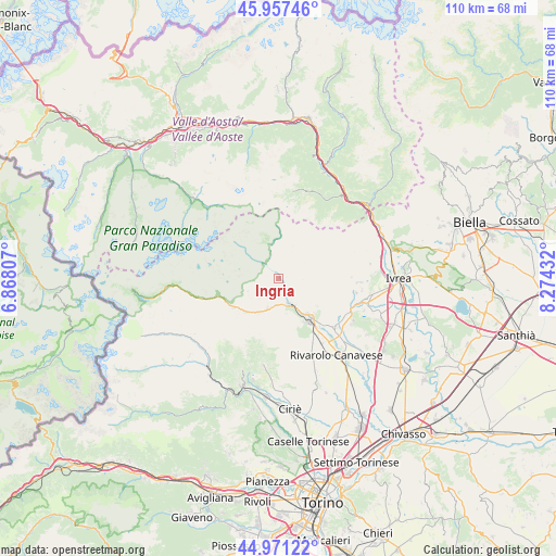
Ingria GPS coordinates[2]
45° 27' 59.4" North, 7° 34' 16.284" East
| Map corner | latitude | longitude |
|---|---|---|
| Upper-left | 45.95746°, | 6.86807° |
| Center: | 45.4665°, | 7.57119° |
| Lower-right: | 44.97122°, | 8.27432° |
| Map W x H: | 109.7×109.7 km | = 68.2×68.2mi |
| max Lat: | 47.04031° ⇑27.6% North |
| Ingria: | 45.4665° |
| min Lat: | ⇓72.4% South 35.50142° |
| min Long | Ingria | max Long |
| 6.69888° | 7.57119° | 18.48682° |
| W 2.7%⇐ | ⇒97.3% E |
Elevation
Elevation of Ingria is 833 m = 2733 ft, and this is 526.3 m = 1727 ft above average elevation for this country.
| Max E: |
2085 m = 6841 ft | 6.2% |
| Ingria | 833 m 2733 ft | |
| Avg. | 306.7 m = 1006 ft | |
Min E: |
-4 m = -13 ft | 93.8% |
See also: Italy elevation on elevation.city.
Geographical zone
Ingria is located in North temperate zone (between Tropic of Cancer and the Arctic Circle). Distance of this North polar circle is 2345.8 km =1457.6 mi to North.| Distance of | km | miles | from Ingria |
|---|---|---|---|
| North Pole | 4951.7 | 3076.8 | to North |
| Arctic Circle | 2345.8 | 1457.6 | to North |
| Tropic Cancer | 2449.5 | 1522 | to South |
| Equator | 5055.4 | 3141.3 | to South |


Nearby cities:
15 places around Ingria: (largest is in red/bold)
• Alpette
6.4 km =4 mi,  175°
175°
• Borgiallo
9.4 km =5.8 mi,  125°
125°
• Canischio
10.4 km =6.5 mi,  169°
169°
• Castelnuovo Nigra
10.1 km =6.3 mi,  108°
108°
• Chiesanuova
8.5 km =5.3 mi, 129°
• Cintano
10.1 km =6.3 mi,  115°
115°
• Colleretto Castelnuovo
9.8 km =6.1 mi, 120°
• Cuorgnè
10.2 km =6.3 mi,  142°
142°
• Frassinetto
4.3 km =2.7 mi, 136°
• Pont-Canavese
5.5 km =3.4 mi,  155°
155°
• Ribordone
6.6 km =4.1 mi,  234°
234°
• Ronco Canavese
4.3 km =2.7 mi,  333°
333°
• San Colombano Belmonte
10.1 km =6.3 mi, 157°
• Sparone
6.1 km =3.8 mi,  199°
199°
• Valprato Soana
6.4 km =4 mi,  344°
344°
Sources, notices
• [Note1] Compared only with cities in Italy existing in our database
• [Src1] Map data: © OpenStreetMap contributors (CC-BY-SA)
• [Src2] Other city data from geonames.org with taken over terms of usage.
• [Src3] Geographical zone / Annual Mean Temperature by Robert A. Rohde @ Wikipedia
