Fontane-Zurane-Gresine geodata
Fontane-Zurane-Gresine (Lombardy) is a seat of a third-order administrative division; located in Italy in Europe/Rome (GMT+2) time zone. With population of 4,806 people, there are 2035 cities with bigger population in this country. Compared to other cities in Italy, 78.4% of cities are located further ↓South; 67.3% of cities are located further →East and 52.7% of cities have higher elevation than Fontane-Zurane-Gresine. Note1
Administrative division(s):
- Level 1: Lombardy
- Level 2: Provincia di Brescia
- Level 3: Provaglio d'Iseo
Current local time in Fontane-Zurane-Gresine:
08:28 PM, WednesdayDifference from your time zone: hours


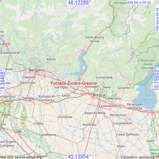
Fontane-Zurane-Gresine GPS coordinates[2]
45° 38' 0.096" North, 10° 2' 49.92" East
| Map corner | latitude | longitude |
|---|---|---|
| Upper-left | 46.12286°, | 9.34408° |
| Center: | 45.63336°, | 10.0472° |
| Lower-right: | 45.13954°, | 10.75033° |
| Map W x H: | 109.3×109.3 km | = 67.9×67.9mi |
| max Lat: | 47.04031° ⇑21.6% North |
| Fontane-Zurane-Gresine: | 45.63336° |
| min Lat: | ⇓78.4% South 35.50142° |
| min Long | Fontane-Zurane- | max Long |
| 6.69888° | 10.0472° | 18.48682° |
| W 32.7%⇐ | ⇒67.3% E |
Elevation
Elevation of Fontane-Zurane-Gresine is 218 m = 715 ft, and this is 88.7 m = 291 ft below average elevation for this country.
| Max E: |
2085 m = 6841 ft | 52.7% |
| Avg. | 306.7 m = 1006 ft | |
| Fontane-Zurane-Gresine | 218 m = 715 ft | |
Min E: |
-4 m = -13 ft | 47.3% |
See also: Italy elevation on elevation.city.
Geographical zone
Fontane-Zurane-Gresine is located in North temperate zone (between Tropic of Cancer and the Arctic Circle). Distance of this North polar circle is 2327.2 km =1446.1 mi to North.| Distance of | km | miles | from Fontane-Zurane-Gresine |
|---|---|---|---|
| North Pole | 4933.1 | 3065.3 | to North |
| Arctic Circle | 2327.2 | 1446.1 | to North |
| Tropic Cancer | 2468 | 1533.5 | to South |
| Equator | 5074 | 3152.8 | to South |


Nearby cities:
15 places around Fontane-Zurane-Gresine: (largest is in red/bold)
• Borgonato
2.7 km =1.7 mi,  238°
238°
• Bornato
4.4 km =2.7 mi,  186°
186°
• Clusane
4.9 km =3 mi,  311°
311°
• Colombaro-Timoline
4.3 km =2.7 mi,  286°
286°
• Corte Franca
4.6 km =2.9 mi,  265°
265°
• Cremignane
2.9 km =1.8 mi, 308°
• Fontana
4.5 km =2.8 mi,  104°
104°
• Iseo
2.8 km =1.7 mi,  4°
4°
• Monterotondo
2.7 km =1.7 mi, 186°
• Monticelli Brusati
4.1 km =2.5 mi,  87°
87°
• Nigoline-Bonomelli
4.7 km =2.9 mi,  264°
264°
• Parmezzana Calzana
3.7 km =2.3 mi, 89°
• Passirano
4.4 km =2.7 mi,  156°
156°
• Provaglio d'Iseo
0.3 km =0.2 mi,  318°
318°
• Provezze
2 km =1.2 mi, 96°
Sources, notices
• [Note1] Compared only with cities in Italy existing in our database
• [Src1] Map data: © OpenStreetMap contributors (CC-BY-SA)
• [Src2] Other city data from geonames.org with taken over terms of usage.
• [Src3] Geographical zone / Annual Mean Temperature by Robert A. Rohde @ Wikipedia
