Gorgoglione geodata
Gorgoglione (Basilicate) is a seat of a third-order administrative division; located in Italy in Europe/Rome (GMT+2) time zone. With population of 1,033 people, there are 6534 cities with bigger population in this country. Compared to other cities in Italy, 84.8% of cities are located further ↑North; 94% of cities are located further ←West and 93.6% of cities have lower elevation than Gorgoglione. Note1


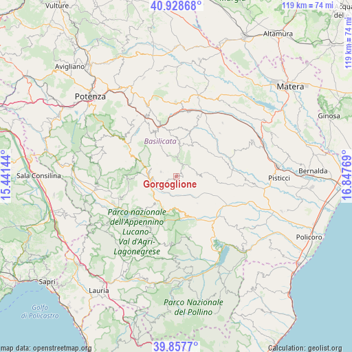
Gorgoglione GPS coordinates[2]
40° 23' 43.152" North, 16° 8' 40.416" East
| Map corner | latitude | longitude |
|---|---|---|
| Upper-left | 40.92868°, | 15.44144° |
| Center: | 40.39532°, | 16.14456° |
| Lower-right: | 39.8577°, | 16.84769° |
| Map W x H: | 119.1×119.1 km | = 74×74mi |
| max Lat: | 47.04031° ⇑84.8% North |
| Gorgoglione: | 40.39532° |
| min Lat: | ⇓15.2% South 35.50142° |
| min Long | Gorgoglione | max Long |
| 6.69888° | 16.14456° | 18.48682° |
| W 94%⇐ | ⇒6% E |
Elevation
Elevation of Gorgoglione is 821 m = 2694 ft, and this is 514.3 m = 1687 ft above average elevation for this country.
| Max E: |
2085 m = 6841 ft | 6.4% |
| Gorgoglione | 821 m 2694 ft | |
| Avg. | 306.7 m = 1006 ft | |
Min E: |
-4 m = -13 ft | 93.6% |
See also: Italy elevation on elevation.city.
Geographical zone
Gorgoglione is located in North temperate zone (between Tropic of Cancer and the Arctic Circle). Distance of this Northern Tropic circle is 1885.6 km =1171.7 mi to South.| Distance of | km | miles | from Gorgoglione |
|---|---|---|---|
| North Pole | 5515.5 | 3427.2 | to North |
| Arctic Circle | 2909.6 | 1807.9 | to North |
| Tropic Cancer | 1885.6 | 1171.7 | to South |
| Equator | 4491.5 | 2790.9 | to South |


Nearby cities:
15 places around Gorgoglione: (largest is in red/bold)
• Accettura
10.7 km =6.6 mi,  6°
6°
• Aliano
11.6 km =7.2 mi,  141°
141°
• Armento
11.9 km =7.4 mi,  214°
214°
• Castelmezzano
17 km =10.6 mi,  330°
330°
• Cirigliano
2.3 km =1.4 mi,  94°
94°
• Corleto Perticara
9 km =5.6 mi,  260°
260°
• Gallicchio
11.5 km =7.1 mi,  183°
183°
• Guardia Perticara
5.4 km =3.4 mi,  226°
226°
• Laurenzana
16.3 km =10.1 mi,  295°
295°
• Missanello
12.6 km =7.8 mi,  171°
171°
• Montemurro
16.9 km =10.5 mi, 230°
• Oliveto Lucano
16 km =9.9 mi, 12°
• Pietrapertosa
15.2 km =9.4 mi, 332°
• San Mauro Forte
13.3 km =8.3 mi,  42°
42°
• Stigliano
7.3 km =4.5 mi,  83°
83°
Sources, notices
• [Note1] Compared only with cities in Italy existing in our database
• [Src1] Map data: © OpenStreetMap contributors (CC-BY-SA)
• [Src2] Other city data from geonames.org with taken over terms of usage.
• [Src3] Geographical zone / Annual Mean Temperature by Robert A. Rohde @ Wikipedia
