Gambasca geodata
Gambasca (Piedmont) is a seat of a third-order administrative division; located in Italy in Europe/Rome (GMT+2) time zone. With population of 147 people, there are 11292 cities with bigger population in this country. Compared to other cities in Italy, 53% of cities are located further ↓South; 98.7% of cities are located further →East and 77.8% of cities have lower elevation than Gambasca. Note1


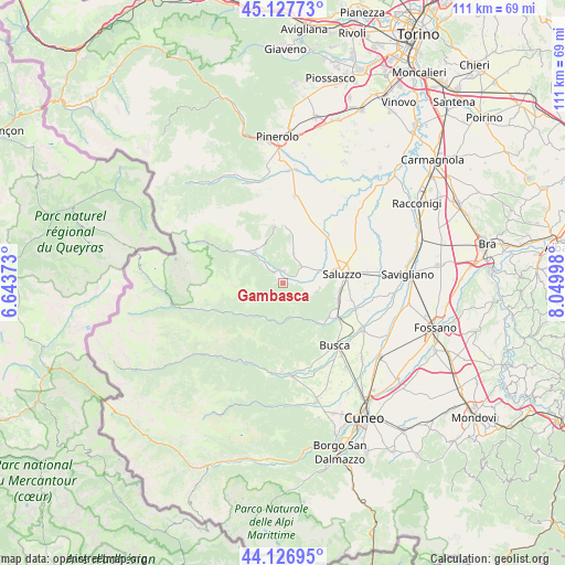
Gambasca GPS coordinates[2]
44° 37' 46.2" North, 7° 20' 48.696" East
| Map corner | latitude | longitude |
|---|---|---|
| Upper-left | 45.12773°, | 6.64373° |
| Center: | 44.6295°, | 7.34686° |
| Lower-right: | 44.12695°, | 8.04998° |
| Map W x H: | 111.3×111.3 km | = 69.2×69.2mi |
| max Lat: | 47.04031° ⇑47% North |
| Gambasca: | 44.6295° |
| min Lat: | ⇓53% South 35.50142° |
| min Long | Gambasca | max Long |
| 6.69888° | 7.34686° | 18.48682° |
| W 1.3%⇐ | ⇒98.7% E |
Elevation
Elevation of Gambasca is 490 m = 1608 ft, and this is 183.3 m = 601 ft above average elevation for this country.
| Max E: |
2085 m = 6841 ft | 22.2% |
| Gambasca | 490 m 1608 ft | |
| Avg. | 306.7 m = 1006 ft | |
Min E: |
-4 m = -13 ft | 77.8% |
See also: Italy elevation on elevation.city.
Geographical zone
Gambasca is located in North temperate zone (between Tropic of Cancer and the Arctic Circle). Distance of this Northern Tropic circle is 2356.4 km =1464.2 mi to South.| Distance of | km | miles | from Gambasca |
|---|---|---|---|
| North Pole | 5044.7 | 3134.6 | to North |
| Arctic Circle | 2438.8 | 1515.4 | to North |
| Tropic Cancer | 2356.4 | 1464.2 | to South |
| Equator | 4962.3 | 3083.4 | to South |


Nearby cities:
15 places around Gambasca: (largest is in red/bold)
• Brondello
5.7 km =3.5 mi,  124°
124°
• Brossasco
7 km =4.3 mi,  168°
168°
• Castellar
7.2 km =4.5 mi,  97°
97°
• Envie
6.2 km =3.9 mi,  18°
18°
• Frassino
8.5 km =5.3 mi,  221°
221°
• Isasca
5.4 km =3.4 mi,  149°
149°
• Martiniana Po
1.3 km =0.8 mi, 101°
• Melle
7.8 km =4.8 mi,  196°
196°
• Paesana
8.2 km =5.1 mi,  316°
316°
• Pagno
6.5 km =4 mi,  107°
107°
• Revello
4.4 km =2.7 mi,  50°
50°
• Rifreddo
2.4 km =1.5 mi,  359°
359°
• Sanfront
2.7 km =1.7 mi, 315°
• Valmala
9.5 km =5.9 mi,  180°
180°
• Venasca
8.6 km =5.3 mi, 152°
Sources, notices
• [Note1] Compared only with cities in Italy existing in our database
• [Src1] Map data: © OpenStreetMap contributors (CC-BY-SA)
• [Src2] Other city data from geonames.org with taken over terms of usage.
• [Src3] Geographical zone / Annual Mean Temperature by Robert A. Rohde @ Wikipedia
