Fornaci geodata
Fornaci (Veneto) is a seat of a third-order administrative division; located in Italy in Europe/Rome (GMT+2) time zone. With population of 2,856 people, there are 3160 cities with bigger population in this country. Compared to other cities in Italy, 79.2% of cities are located further ↓South; 61.7% of cities are located further ←West and 97.8% of cities have higher elevation than Fornaci. Note1
Administrative division(s):
- Level 1: Veneto
- Level 2: Provincia di Treviso
- Level 3: Monastier di Treviso


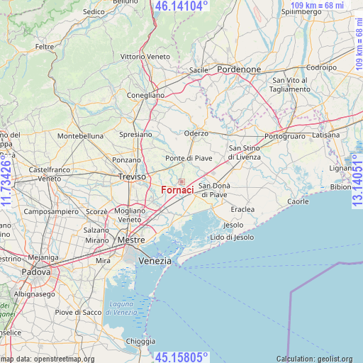
Fornaci GPS coordinates[2]
45° 39' 6.12" North, 12° 26' 14.568" East
| Map corner | latitude | longitude |
|---|---|---|
| Upper-left | 46.14104°, | 11.73426° |
| Center: | 45.6517°, | 12.43738° |
| Lower-right: | 45.15805°, | 13.14051° |
| Map W x H: | 109.3×109.3 km | = 67.9×67.9mi |
| max Lat: | 47.04031° ⇑20.8% North |
| Fornaci: | 45.6517° |
| min Lat: | ⇓79.2% South 35.50142° |
| min Long | Fornaci | max Long |
| 6.69888° | 12.43738° | 18.48682° |
| W 61.7%⇐ | ⇒38.3% E |
Elevation
Elevation of Fornaci is 4 m = 13 ft, and this is 302.7 m = 993 ft below average elevation for this country.
| Max E: |
2085 m = 6841 ft | 97.8% |
| Avg. | 306.7 m = 1006 ft | |
| Fornaci | 4 m = 13 ft | |
Min E: |
-4 m = -13 ft | 2.2% |
See also: Italy elevation on elevation.city.
Geographical zone
Fornaci is located in North temperate zone (between Tropic of Cancer and the Arctic Circle). Distance of this North polar circle is 2325.2 km =1444.8 mi to North.| Distance of | km | miles | from Fornaci |
|---|---|---|---|
| North Pole | 4931.1 | 3064 | to North |
| Arctic Circle | 2325.2 | 1444.8 | to North |
| Tropic Cancer | 2470.1 | 1534.8 | to South |
| Equator | 5076 | 3154.1 | to South |


Nearby cities:
15 places around Fornaci: (largest is in red/bold)
• Biancade
6.2 km =3.9 mi,  266°
266°
• Bocca Callalta
5.9 km =3.7 mi,  3°
3°
• Croce
7 km =4.3 mi,  107°
107°
• Fagarè
6.2 km =3.9 mi,  353°
353°
• Fossalta di Piave
5.6 km =3.5 mi,  97°
97°
• Losson della Battaglia
4 km =2.5 mi,  121°
121°
• Meolo
3.7 km =2.3 mi,  161°
161°
• Monastier di Treviso
1.7 km =1.1 mi,  293°
293°
• Noventa di Piave
7.5 km =4.7 mi,  83°
83°
• Roncade
5.8 km =3.6 mi,  234°
234°
• Rovarè
4 km =2.5 mi,  319°
319°
• Salgareda
7.1 km =4.4 mi,  33°
33°
• San Biagio di Callalta
5.9 km =3.7 mi,  307°
307°
• Talponada
7.1 km =4.4 mi,  35°
35°
• Zenson di Piave
5.1 km =3.2 mi,  52°
52°
Sources, notices
• [Note1] Compared only with cities in Italy existing in our database
• [Src1] Map data: © OpenStreetMap contributors (CC-BY-SA)
• [Src2] Other city data from geonames.org with taken over terms of usage.
• [Src3] Geographical zone / Annual Mean Temperature by Robert A. Rohde @ Wikipedia
