Faedo Valtellino geodata
Faedo Valtellino (Lombardy) is a seat of a third-order administrative division; located in Italy in Europe/Rome (GMT+2) time zone. With population of 539 people, there are 9552 cities with bigger population in this country. Compared to other cities in Italy, 95.1% of cities are located further ↓South; 68.8% of cities are located further →East and 81.8% of cities have lower elevation than Faedo Valtellino. Note1
Administrative division(s):
- Level 1: Lombardy
- Level 2: Provincia di Sondrio
- Level 3: Faedo Valtellino


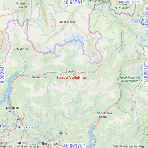
Faedo Valtellino GPS coordinates[2]
46° 9' 10.764" North, 9° 54' 21.78" East
| Map corner | latitude | longitude |
|---|---|---|
| Upper-left | 46.63791°, | 9.20293° |
| Center: | 46.15299°, | 9.90605° |
| Lower-right: | 45.66375°, | 10.60918° |
| Map W x H: | 108.3×108.3 km | = 67.3×67.3mi |
| max Lat: | 47.04031° ⇑4.9% North |
| Faedo Valtellino: | 46.15299° |
| min Lat: | ⇓95.1% South 35.50142° |
| min Long | Faedo Valtellin | max Long |
| 6.69888° | 9.90605° | 18.48682° |
| W 31.2%⇐ | ⇒68.8% E |
Elevation
Elevation of Faedo Valtellino is 550 m = 1804 ft, and this is 243.3 m = 798 ft above average elevation for this country.
| Max E: |
2085 m = 6841 ft | 18.2% |
| Faedo Valtellino | 550 m 1804 ft | |
| Avg. | 306.7 m = 1006 ft | |
Min E: |
-4 m = -13 ft | 81.8% |
See also: Italy elevation on elevation.city.
Geographical zone
Faedo Valtellino is located in North temperate zone (between Tropic of Cancer and the Arctic Circle). Distance of this North polar circle is 2269.4 km =1410.1 mi to North.| Distance of | km | miles | from Faedo Valtellino |
|---|---|---|---|
| North Pole | 4875.3 | 3029.4 | to North |
| Arctic Circle | 2269.4 | 1410.1 | to North |
| Tropic Cancer | 2525.8 | 1569.5 | to South |
| Equator | 5131.7 | 3188.7 | to South |


Nearby cities:
15 places around Faedo Valtellino: (largest is in red/bold)
• Albosaggia
4.1 km =2.5 mi,  261°
261°
• Boffetto
3.9 km =2.4 mi,  77°
77°
• Caiolo
7.1 km =4.4 mi,  267°
267°
• Castionetto
8 km =5 mi,  71°
71°
• Chiuro
6.3 km =3.9 mi, 75°
• Montagna in Valtellina
2.8 km =1.7 mi,  355°
355°
• Mossini
4.4 km =2.7 mi,  311°
311°
• Piateda Centro
2.3 km =1.4 mi, 71°
• Poggiridenti Alto
2.9 km =1.8 mi,  32°
32°
• Poggiridenti Piano
2.5 km =1.6 mi,  40°
40°
• Ponchiera
4.1 km =2.5 mi,  319°
319°
• Ponte in Valtellina
6 km =3.7 mi, 66°
• Sondrio
3.2 km =2 mi,  302°
302°
• Torchione-Moia
3.6 km =2.2 mi, 273°
• Tresivio
3.8 km =2.4 mi,  48°
48°
Sources, notices
• [Note1] Compared only with cities in Italy existing in our database
• [Src1] Map data: © OpenStreetMap contributors (CC-BY-SA)
• [Src2] Other city data from geonames.org with taken over terms of usage.
• [Src3] Geographical zone / Annual Mean Temperature by Robert A. Rohde @ Wikipedia
