Ponchiera geodata
Ponchiera (Lombardy) is a populated place; located in Italy in Europe/Rome (GMT+2) time zone. With population of 719 people, there are 8161 cities with bigger population in this country. Compared to other cities in Italy, 95.8% of cities are located further ↓South; 69.1% of cities are located further →East and 77.4% of cities have lower elevation than Ponchiera. Note1


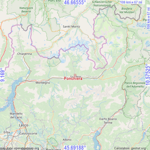
Ponchiera GPS coordinates[2]
46° 10' 51.132" North, 9° 52' 19.632" East
| Map corner | latitude | longitude |
|---|---|---|
| Upper-left | 46.66555°, | 9.169° |
| Center: | 46.18087°, | 9.87212° |
| Lower-right: | 45.69188°, | 10.57525° |
| Map W x H: | 108.3×108.3 km | = 67.3×67.3mi |
| max Lat: | 47.04031° ⇑4.2% North |
| Ponchiera: | 46.18087° |
| min Lat: | ⇓95.8% South 35.50142° |
| min Long | Ponchiera | max Long |
| 6.69888° | 9.87212° | 18.48682° |
| W 30.9%⇐ | ⇒69.1% E |
Elevation
Elevation of Ponchiera is 485 m = 1591 ft, and this is 178.3 m = 585 ft above average elevation for this country.
| Max E: |
2085 m = 6841 ft | 22.6% |
| Ponchiera | 485 m 1591 ft | |
| Avg. | 306.7 m = 1006 ft | |
Min E: |
-4 m = -13 ft | 77.4% |
See also: Italy elevation on elevation.city.
Geographical zone
Ponchiera is located in North temperate zone (between Tropic of Cancer and the Arctic Circle). Distance of this North polar circle is 2266.3 km =1408.2 mi to North.| Distance of | km | miles | from Ponchiera |
|---|---|---|---|
| North Pole | 4872.2 | 3027.4 | to North |
| Arctic Circle | 2266.3 | 1408.2 | to North |
| Tropic Cancer | 2528.9 | 1571.4 | to South |
| Equator | 5134.8 | 3190.6 | to South |


Nearby cities:
15 places around Ponchiera: (largest is in red/bold)
• Albosaggia
4 km =2.5 mi,  200°
200°
• Caiolo
5.6 km =3.5 mi,  232°
232°
• Castione
5.6 km =3.5 mi,  260°
260°
• Castione Andevenno
5.6 km =3.5 mi, 260°
• Faedo Valtellino
4.1 km =2.5 mi,  139°
139°
• Montagna in Valtellina
2.4 km =1.5 mi,  96°
96°
• Mossini
0.7 km =0.4 mi,  253°
253°
• Piateda Centro
5.4 km =3.4 mi,  116°
116°
• Poggiridenti Alto
4.2 km =2.6 mi, 99°
• Poggiridenti Piano
4.4 km =2.7 mi,  106°
106°
• Sondrio
1.4 km =0.9 mi,  182°
182°
• Spriana
4.4 km =2.7 mi,  352°
352°
• Torchione-Moia
3 km =1.9 mi, 197°
• Torre di Santa Maria
6.1 km =3.8 mi, 345°
• Tresivio
5.5 km =3.4 mi, 96°
Sources, notices
• [Note1] Compared only with cities in Italy existing in our database
• [Src1] Map data: © OpenStreetMap contributors (CC-BY-SA)
• [Src2] Other city data from geonames.org with taken over terms of usage.
• [Src3] Geographical zone / Annual Mean Temperature by Robert A. Rohde @ Wikipedia
