Tresivio geodata
Tresivio (Lombardy) is a seat of a third-order administrative division; located in Italy in Europe/Rome (GMT+2) time zone. With population of 1,876 people, there are 4363 cities with bigger population in this country. Compared to other cities in Italy, 95.7% of cities are located further ↓South; 68.4% of cities are located further →East and 78.5% of cities have lower elevation than Tresivio. Note1


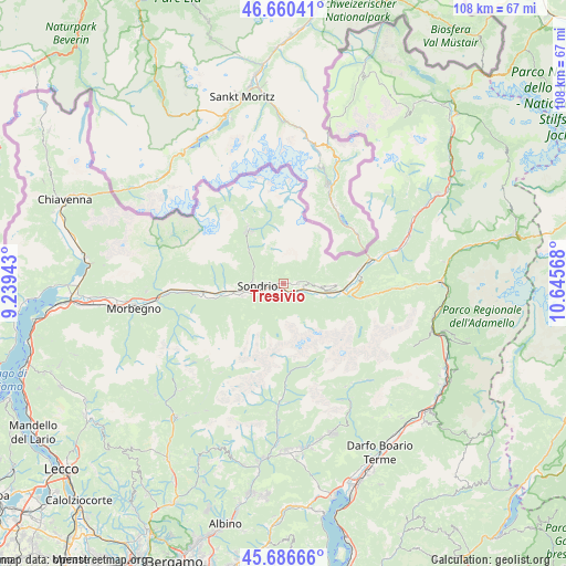
Tresivio GPS coordinates[2]
46° 10' 32.484" North, 9° 56' 33.18" East
| Map corner | latitude | longitude |
|---|---|---|
| Upper-left | 46.66041°, | 9.23943° |
| Center: | 46.17569°, | 9.94255° |
| Lower-right: | 45.68666°, | 10.64568° |
| Map W x H: | 108.3×108.3 km | = 67.3×67.3mi |
| max Lat: | 47.04031° ⇑4.3% North |
| Tresivio: | 46.17569° |
| min Lat: | ⇓95.7% South 35.50142° |
| min Long | Tresivio | max Long |
| 6.69888° | 9.94255° | 18.48682° |
| W 31.6%⇐ | ⇒68.4% E |
Elevation
Elevation of Tresivio is 500 m = 1640 ft, and this is 193.3 m = 634 ft above average elevation for this country.
| Max E: |
2085 m = 6841 ft | 21.5% |
| Tresivio | 500 m 1640 ft | |
| Avg. | 306.7 m = 1006 ft | |
Min E: |
-4 m = -13 ft | 78.5% |
See also: Italy elevation on elevation.city.
Geographical zone
Tresivio is located in North temperate zone (between Tropic of Cancer and the Arctic Circle). Distance of this North polar circle is 2266.9 km =1408.6 mi to North.| Distance of | km | miles | from Tresivio |
|---|---|---|---|
| North Pole | 4872.8 | 3027.8 | to North |
| Arctic Circle | 2266.9 | 1408.6 | to North |
| Tropic Cancer | 2528.3 | 1571 | to South |
| Equator | 5134.3 | 3190.3 | to South |


Nearby cities:
15 places around Tresivio: (largest is in red/bold)
• Boffetto
2 km =1.2 mi,  149°
149°
• Castello dell'Acqua
6.6 km =4.1 mi,  120°
120°
• Castionetto
4.8 km =3 mi,  89°
89°
• Chiuro
3.5 km =2.2 mi,  105°
105°
• Faedo Valtellino
3.8 km =2.4 mi,  228°
228°
• Montagna in Valtellina
3.1 km =1.9 mi,  275°
275°
• Mossini
6.1 km =3.8 mi,  273°
273°
• Piateda Centro
1.9 km =1.2 mi,  198°
198°
• Poggiridenti Alto
1.3 km =0.8 mi, 265°
• Poggiridenti Piano
1.4 km =0.9 mi,  242°
242°
• Ponchiera
5.5 km =3.4 mi, 276°
• Ponte in Valtellina
2.7 km =1.7 mi, 91°
• San Giacomo
6.6 km =4.1 mi, 105°
• Sondrio
5.5 km =3.4 mi,  261°
261°
• Torchione-Moia
6.8 km =4.2 mi,  249°
249°
Sources, notices
• [Note1] Compared only with cities in Italy existing in our database
• [Src1] Map data: © OpenStreetMap contributors (CC-BY-SA)
• [Src2] Other city data from geonames.org with taken over terms of usage.
• [Src3] Geographical zone / Annual Mean Temperature by Robert A. Rohde @ Wikipedia
