Cornale geodata
Cornale (Lombardy) is a seat of a third-order administrative division; located in Italy in Europe/Rome (GMT+2) time zone. With population of 707 people, there are 8250 cities with bigger population in this country. Compared to other cities in Italy, 61% of cities are located further ↓South; 82.5% of cities are located further →East and 74.5% of cities have higher elevation than Cornale. Note1
Administrative division(s):
- Level 1: Lombardy
- Level 2: Provincia di Pavia
- Level 3: Cornale e Bastida


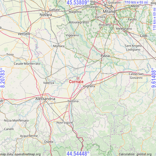
Cornale GPS coordinates[2]
45° 2' 36.384" North, 8° 54' 39.456" East
| Map corner | latitude | longitude |
|---|---|---|
| Upper-left | 45.53809°, | 8.20783° |
| Center: | 45.04344°, | 8.91096° |
| Lower-right: | 44.54448°, | 9.61408° |
| Map W x H: | 110.5×110.5 km | = 68.7×68.7mi |
| max Lat: | 47.04031° ⇑39% North |
| Cornale: | 45.04344° |
| min Lat: | ⇓61% South 35.50142° |
| min Long | Cornale | max Long |
| 6.69888° | 8.91096° | 18.48682° |
| W 17.5%⇐ | ⇒82.5% E |
Elevation
Elevation of Cornale is 76 m = 249 ft, and this is 230.7 m = 757 ft below average elevation for this country.
| Max E: |
2085 m = 6841 ft | 74.5% |
| Avg. | 306.7 m = 1006 ft | |
| Cornale | 76 m = 249 ft | |
Min E: |
-4 m = -13 ft | 25.5% |
See also: Italy elevation on elevation.city.
Geographical zone
Cornale is located in North temperate zone (between Tropic of Cancer and the Arctic Circle). Distance of this North polar circle is 2392.8 km =1486.8 mi to North.| Distance of | km | miles | from Cornale |
|---|---|---|---|
| North Pole | 4998.7 | 3106 | to North |
| Arctic Circle | 2392.8 | 1486.8 | to North |
| Tropic Cancer | 2402.4 | 1492.8 | to South |
| Equator | 5008.4 | 3112.1 | to South |


Nearby cities:
15 places around Cornale: (largest is in red/bold)
• Alzano Scrivia
3.7 km =2.3 mi,  220°
220°
• Bastida de' Dossi
0.9 km =0.6 mi,  116°
116°
• Casei
4.2 km =2.6 mi,  162°
162°
• Castelnuovo Scrivia
7.5 km =4.7 mi,  197°
197°
• Cervesina
8.5 km =5.3 mi,  77°
77°
• Corana
5.1 km =3.2 mi,  64°
64°
• Ferrera Erbognone
8.7 km =5.4 mi,  335°
335°
• Guazzora
5.9 km =3.7 mi,  236°
236°
• Isola Sant'Antonio
5.1 km =3.2 mi,  253°
253°
• Mezzana Bigli
5.3 km =3.3 mi,  290°
290°
• Molino dei Torti
2.5 km =1.6 mi,  212°
212°
• Pieve Albignola
8.7 km =5.4 mi,  26°
26°
• Pieve del Cairo
8.5 km =5.3 mi,  274°
274°
• Sannazzaro de' Burgondi
6.6 km =4.1 mi,  356°
356°
• Silvano Pietra
2.8 km =1.7 mi,  99°
99°
Sources, notices
• [Note1] Compared only with cities in Italy existing in our database
• [Src1] Map data: © OpenStreetMap contributors (CC-BY-SA)
• [Src2] Other city data from geonames.org with taken over terms of usage.
• [Src3] Geographical zone / Annual Mean Temperature by Robert A. Rohde @ Wikipedia
