Cogolo geodata
Cogolo (Trentino-Alto Adige) is a seat of a third-order administrative division; located in Italy in Europe/Rome (GMT+2) time zone. With population of 742 people, there are 8007 cities with bigger population in this country. Compared to other cities in Italy, 97.3% of cities are located further ↓South; 61% of cities are located further →East and 98.4% of cities have lower elevation than Cogolo. Note1
Administrative division(s):
- Level 1: Trentino-Alto Adige
- Level 2: Provincia autonoma di Trento
- Level 3: Peio


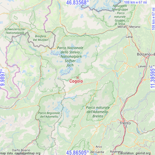
Cogolo GPS coordinates[2]
46° 21' 9.072" North, 10° 41' 34.152" East
| Map corner | latitude | longitude |
|---|---|---|
| Upper-left | 46.83568°, | 9.9897° |
| Center: | 46.35252°, | 10.69282° |
| Lower-right: | 45.86505°, | 11.39595° |
| Map W x H: | 107.9×107.9 km | = 67×67mi |
| max Lat: | 47.04031° ⇑2.7% North |
| Cogolo: | 46.35252° |
| min Lat: | ⇓97.3% South 35.50142° |
| min Long | Cogolo | max Long |
| 6.69888° | 10.69282° | 18.48682° |
| W 39%⇐ | ⇒61% E |
Elevation
Elevation of Cogolo is 1167 m = 3829 ft, and this is 860.3 m = 2823 ft above average elevation for this country.
| Max E: |
2085 m = 6841 ft | 1.6% |
| Cogolo | 1167 m 3829 ft | |
| Avg. | 306.7 m = 1006 ft | |
Min E: |
-4 m = -13 ft | 98.4% |
See also: Italy elevation on elevation.city.
Geographical zone
Cogolo is located in North temperate zone (between Tropic of Cancer and the Arctic Circle). Distance of this North polar circle is 2247.3 km =1396.4 mi to North.| Distance of | km | miles | from Cogolo |
|---|---|---|---|
| North Pole | 4853.1 | 3015.6 | to North |
| Arctic Circle | 2247.3 | 1396.4 | to North |
| Tropic Cancer | 2548 | 1583.3 | to South |
| Equator | 5153.9 | 3202.5 | to South |


Nearby cities:
15 places around Cogolo: (largest is in red/bold)
• Commezzadura
11.8 km =7.3 mi,  106°
106°
• Croviana
16.2 km =10.1 mi,  93°
93°
• Dimaro
14.2 km =8.8 mi,  102°
102°
• Dimaro-Folgarida
13.9 km =8.6 mi, 99°
• Fraviano
6.2 km =3.9 mi,  180°
180°
• Madonna di Campiglio
17.3 km =10.7 mi,  143°
143°
• Malè
16.9 km =10.5 mi, 89°
• Mezzana
9.1 km =5.7 mi,  115°
115°
• Monclassico
15 km =9.3 mi, 97°
• Ossana
6.2 km =3.9 mi,  146°
146°
• Pellizzano
6.9 km =4.3 mi,  133°
133°
• Ponte di Legno
17.4 km =10.8 mi,  233°
233°
• Rabbi Fonti
13.1 km =8.1 mi,  66°
66°
• San Bernardo
12.8 km =8 mi, 65°
• Vermiglio
6.2 km =3.9 mi, 181°
Sources, notices
• [Note1] Compared only with cities in Italy existing in our database
• [Src1] Map data: © OpenStreetMap contributors (CC-BY-SA)
• [Src2] Other city data from geonames.org with taken over terms of usage.
• [Src3] Geographical zone / Annual Mean Temperature by Robert A. Rohde @ Wikipedia
