Codemondo-Quaresimo geodata
Codemondo-Quaresimo (Emilia-Romagna) is a populated place; located in Italy in Europe/Rome (GMT+2) time zone. With population of 1,244 people, there are 5812 cities with bigger population in this country. Compared to other cities in Italy, 54.1% of cities are located further ↓South; 62.3% of cities are located further →East and 76.8% of cities have higher elevation than Codemondo-Quaresimo. Note1
Administrative division(s):
- Level 1: Emilia-Romagna
- Level 2: Provincia di Reggio Emilia
- Level 3: Reggio nell'Emilia


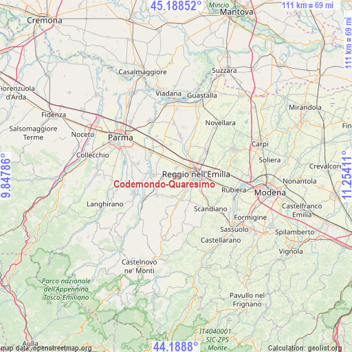
Codemondo-Quaresimo GPS coordinates[2]
44° 41' 26.952" North, 10° 33' 3.528" East
| Map corner | latitude | longitude |
|---|---|---|
| Upper-left | 45.18852°, | 9.84786° |
| Center: | 44.69082°, | 10.55098° |
| Lower-right: | 44.1888°, | 11.25411° |
| Map W x H: | 111.2×111.2 km | = 69.1×69.1mi |
| max Lat: | 47.04031° ⇑45.9% North |
| Codemondo-Quaresimo: | 44.69082° |
| min Lat: | ⇓54.1% South 35.50142° |
| min Long | Codemondo-Quare | max Long |
| 6.69888° | 10.55098° | 18.48682° |
| W 37.7%⇐ | ⇒62.3% E |
Elevation
Elevation of Codemondo-Quaresimo is 65 m = 213 ft, and this is 241.7 m = 793 ft below average elevation for this country.
| Max E: |
2085 m = 6841 ft | 76.8% |
| Avg. | 306.7 m = 1006 ft | |
| Codemondo-Quaresimo | 65 m = 213 ft | |
Min E: |
-4 m = -13 ft | 23.2% |
See also: Italy elevation on elevation.city.
Geographical zone
Codemondo-Quaresimo is located in North temperate zone (between Tropic of Cancer and the Arctic Circle). Distance of this Northern Tropic circle is 2363.2 km =1468.4 mi to South.| Distance of | km | miles | from Codemondo-Quaresimo |
|---|---|---|---|
| North Pole | 5037.9 | 3130.4 | to North |
| Arctic Circle | 2432 | 1511.2 | to North |
| Tropic Cancer | 2363.2 | 1468.4 | to South |
| Equator | 4969.2 | 3087.7 | to South |


Nearby cities:
15 places around Codemondo-Quaresimo: (largest is in red/bold)
• Albinea
8.4 km =5.2 mi,  145°
145°
• Barco
4.4 km =2.7 mi,  266°
266°
• Bibbiano
6.8 km =4.2 mi,  243°
243°
• Cadè-Gaida
6 km =3.7 mi,  332°
332°
• Calerno
8.2 km =5.1 mi,  321°
321°
• Cavriago
2 km =1.2 mi,  281°
281°
• Forche
6.3 km =3.9 mi,  163°
163°
• Ghiardo
4.5 km =2.8 mi,  233°
233°
• Montecavolo
6.5 km =4 mi,  185°
185°
• Montecchio Emilia
7.9 km =4.9 mi, 276°
• Puianello
7.2 km =4.5 mi,  171°
171°
• Reggio nell'Emilia
6.4 km =4 mi,  82°
82°
• Roncocesi
5.7 km =3.5 mi,  22°
22°
• Roncolo
7.6 km =4.7 mi,  213°
213°
• San Bartolomeo
2.1 km =1.3 mi, 206°
Sources, notices
• [Note1] Compared only with cities in Italy existing in our database
• [Src1] Map data: © OpenStreetMap contributors (CC-BY-SA)
• [Src2] Other city data from geonames.org with taken over terms of usage.
• [Src3] Geographical zone / Annual Mean Temperature by Robert A. Rohde @ Wikipedia
