Forche geodata
Forche (Emilia-Romagna) is a populated place; located in Italy in Europe/Rome (GMT+2) time zone. With population of 1,330 people, there are 5545 cities with bigger population in this country. Compared to other cities in Italy, 53.1% of cities are located further ↓South; 62.1% of cities are located further →East and 62.3% of cities have higher elevation than Forche. Note1
Administrative division(s):
- Level 1: Emilia-Romagna
- Level 2: Provincia di Reggio Emilia
- Level 3: Quattro Castella


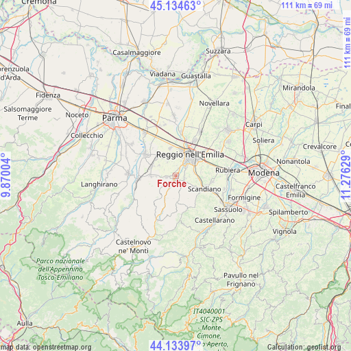
Forche GPS coordinates[2]
44° 38' 11.256" North, 10° 34' 23.376" East
| Map corner | latitude | longitude |
|---|---|---|
| Upper-left | 45.13463°, | 9.87004° |
| Center: | 44.63646°, | 10.57316° |
| Lower-right: | 44.13397°, | 11.27629° |
| Map W x H: | 111.3×111.3 km | = 69.2×69.2mi |
| max Lat: | 47.04031° ⇑46.9% North |
| Forche: | 44.63646° |
| min Lat: | ⇓53.1% South 35.50142° |
| min Long | Forche | max Long |
| 6.69888° | 10.57316° | 18.48682° |
| W 37.9%⇐ | ⇒62.1% E |
Elevation
Elevation of Forche is 147 m = 482 ft, and this is 159.7 m = 524 ft below average elevation for this country.
| Max E: |
2085 m = 6841 ft | 62.3% |
| Avg. | 306.7 m = 1006 ft | |
| Forche | 147 m = 482 ft | |
Min E: |
-4 m = -13 ft | 37.7% |
See also: Italy elevation on elevation.city.
Geographical zone
Forche is located in North temperate zone (between Tropic of Cancer and the Arctic Circle). Distance of this Northern Tropic circle is 2357.2 km =1464.7 mi to South.| Distance of | km | miles | from Forche |
|---|---|---|---|
| North Pole | 5044 | 3134.2 | to North |
| Arctic Circle | 2438.1 | 1515 | to North |
| Tropic Cancer | 2357.2 | 1464.7 | to South |
| Equator | 4963.1 | 3083.9 | to South |


Nearby cities:
15 places around Forche: (largest is in red/bold)
• Albinea
3.1 km =1.9 mi,  106°
106°
• Borzano
6.2 km =3.9 mi,  125°
125°
• Bosco
7.9 km =4.9 mi,  101°
101°
• Cavriago
7.5 km =4.7 mi,  329°
329°
• Codemondo-Quaresimo
6.3 km =3.9 mi,  343°
343°
• Fogliano
5.8 km =3.6 mi,  77°
77°
• Gavasseto
8.4 km =5.2 mi, 76°
• Ghiardo
6.3 km =3.9 mi,  301°
301°
• Montecavolo
2.4 km =1.5 mi,  260°
260°
• Puianello
1.3 km =0.8 mi,  212°
212°
• Quattro Castella
7.8 km =4.8 mi,  268°
268°
• Reggio nell'Emilia
8.3 km =5.2 mi,  33°
33°
• Roncolo
6 km =3.7 mi, 267°
• San Bartolomeo
5 km =3.1 mi, 327°
• Vezzano sul Crostolo
4.4 km =2.7 mi, 210°
Sources, notices
• [Note1] Compared only with cities in Italy existing in our database
• [Src1] Map data: © OpenStreetMap contributors (CC-BY-SA)
• [Src2] Other city data from geonames.org with taken over terms of usage.
• [Src3] Geographical zone / Annual Mean Temperature by Robert A. Rohde @ Wikipedia
