Cireglio geodata
Cireglio (Tuscany) is a populated place; located in Italy in Europe/Rome (GMT+2) time zone. With population of 768 people, there are 7830 cities with bigger population in this country. Compared to other cities in Italy, 54.8% of cities are located further ↑North; 59.1% of cities are located further →East and 84.8% of cities have lower elevation than Cireglio. Note1


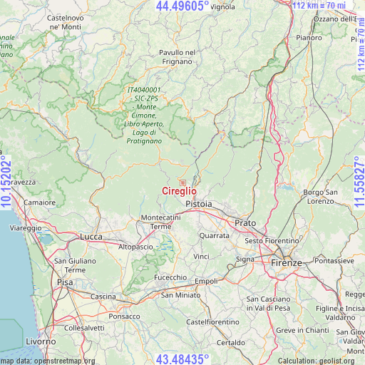
Cireglio GPS coordinates[2]
43° 59' 32.496" North, 10° 51' 18.504" East
| Map corner | latitude | longitude |
|---|---|---|
| Upper-left | 44.49605°, | 10.15202° |
| Center: | 43.99236°, | 10.85514° |
| Lower-right: | 43.48435°, | 11.55827° |
| Map W x H: | 112.5×112.5 km | = 69.9×69.9mi |
| max Lat: | 47.04031° ⇑54.8% North |
| Cireglio: | 43.99236° |
| min Lat: | ⇓45.2% South 35.50142° |
| min Long | Cireglio | max Long |
| 6.69888° | 10.85514° | 18.48682° |
| W 40.9%⇐ | ⇒59.1% E |
Elevation
Elevation of Cireglio is 607 m = 1991 ft, and this is 300.3 m = 985 ft above average elevation for this country.
| Max E: |
2085 m = 6841 ft | 15.2% |
| Cireglio | 607 m 1991 ft | |
| Avg. | 306.7 m = 1006 ft | |
Min E: |
-4 m = -13 ft | 84.8% |
See also: Italy elevation on elevation.city.
Geographical zone
Cireglio is located in North temperate zone (between Tropic of Cancer and the Arctic Circle). Distance of this Northern Tropic circle is 2285.6 km =1420.2 mi to South.| Distance of | km | miles | from Cireglio |
|---|---|---|---|
| North Pole | 5115.6 | 3178.7 | to North |
| Arctic Circle | 2509.7 | 1559.5 | to North |
| Tropic Cancer | 2285.6 | 1420.2 | to South |
| Equator | 4891.5 | 3039.4 | to South |


Nearby cities:
15 places around Cireglio: (largest is in red/bold)
• Campo Tizzoro
5.3 km =3.3 mi,  357°
357°
• Gavinana
7.3 km =4.5 mi,  338°
338°
• Marliana
9.4 km =5.8 mi,  226°
226°
• Massa
12.8 km =8 mi,  223°
223°
• Monsummano Terme
14.3 km =8.9 mi,  193°
193°
• Montale
14.4 km =8.9 mi,  116°
116°
• Montecatini-Terme
14 km =8.7 mi,  208°
208°
• Pieve a Nievole
13.1 km =8.1 mi,  199°
199°
• Pistoia
8.8 km =5.5 mi,  141°
141°
• Piteglio
8.2 km =5.1 mi,  298°
298°
• Ponte di Serravalle
11.1 km =6.9 mi, 194°
• Ponzano
9.2 km =5.7 mi,  109°
109°
• San Marcello Pistoiese
8.6 km =5.3 mi,  325°
325°
• Serravalle Pistoiese
9.8 km =6.1 mi, 190°
• Stazione Masotti
9.2 km =5.7 mi,  180°
180°
Sources, notices
• [Note1] Compared only with cities in Italy existing in our database
• [Src1] Map data: © OpenStreetMap contributors (CC-BY-SA)
• [Src2] Other city data from geonames.org with taken over terms of usage.
• [Src3] Geographical zone / Annual Mean Temperature by Robert A. Rohde @ Wikipedia
